Raglan, Queensland
Download coordinates as: Raglan is a rural town and locality in the Gladstone Region, Queensland, Australia.
The locality contains the following mountains: These ranges are a significant source of marble and calcite, and the South Ulam mine is located there.
[13] The Bruce Highway enters the locality from the east (Ambrose), passes through the town along Raglan Street, and exits to the north-west (Marmor).
[16] There are two airstrips in the locality: The region was first declared as the County of Raglan and opened for British pastoral squatting in January 1854.
[2][3] British occupation began in early January 1856 during a punitive expedition led by Lieutenant John Murray of the Native Police.
Murray was tracking down local Aboriginal tribes suspected of involvement in the killing of five people at nearby Mount Larcombe sheep station.
With a posse comitatus of around twenty armed and mounted men, including troopers, constables and colonists, Murray surrounded a "large mob" of about a hundred Aboriginal people camped on a creek near to where the township of Raglan now stands.
Many of the Aboriginal people were killed or terribly wounded but no casualties were recorded amongst Murray's group.
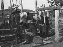
[22] Raglan was established as a pastoral sheep station in 1857 by William Landsborough who held it for several years before selling it on.
[34][14] Langmorn Creek Crossing Provisional School opened on 20 October 1915 but closed circa 31 January 1916.