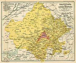
Rajputana
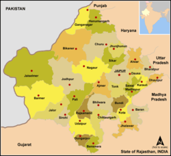
Rājputana, meaning Land of the Rajputs,[1] was a region in the Indian subcontinent that included mainly the present-day Indian state of Rajasthan, as well as parts of Madhya Pradesh and Gujarat,[1] and some adjoining areas of Sindh in modern-day southern Pakistan.
[3] The name was later adopted by East India Company as the Rajputana Agency for its dependencies in the region of the present-day Indian state of Rājasthān.
[5] The historian John Keay in his book, India: A History, stated that the Rajputana name was coined by the British, but that the word achieved a retrospective authenticity: in an 1829 translation of Ferishta's history of early Islamic India, John Briggs discarded the phrase "Indian princes", as rendered in Dow's earlier version, and substituted "Rajpoot princes".
[6][7] The area of Rajputana is estimated to be 343,328 square km (132,559 square miles) and breaks down into two geographic divisions: The whole area forms the hill and plateau country between the north Indian plains and the main plateau of peninsular India.
[citation needed] The territory consisted of 23 states, one Sardari, one Jagir and the British district of Ajmer-Mewar.