Ramla
This page is subject to the extended confirmed restriction related to the Arab-Israeli conflict.Ramla or Ramle (Hebrew: רַמְלָה, Ramlā; Arabic: الرملة, ar-Ramleh)[2] is a city in the Central District of Israel.
Not long after its establishment, Ramla developed as the commercial centre of Palestine, serving as a hub for pottery, dyeing, weaving, and olive oil, and as the home of numerous Muslim scholars.
[1][3] The Umayyad prince and governor of Palestine, Sulayman ibn Abd al-Malik, founded Ramla as the seat of his administration,[6][7][8] replacing Lydda, the Muslims' original provincial capital.
This was likely due to a lack of available space for wide-scale development and agreements dating to the Muslim conquest in the 630s that, at least formally, precluded him from confiscating desirable property within Lydda.
[12] In a tradition recorded by the historian Ibn Fadlallah al-Umari (died 1347), a determined local Christian cleric refused Sulayman's requests for plots in the middle of Lydda.
Infuriated, he attempted to have the cleric executed, but his local adviser Raja ibn Haywa dissuaded him and instead proposed building a new city at a superior, adjacent site.
[14] In choosing the site, Sulayman utilized the strategic advantages of Lydda's vicinity while avoiding the physical constraints of an already-established urban center.
[15] Historian Moshe Sharon holds that Lydda was "too Christian in ethos for the taste of the Umayyad rulers", particularly following the Arabization and Islamization reforms instituted by Abd al-Malik.
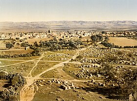
[20] From early on, Ramla developed economically as a market town for the surrounding area's agricultural products, and as a center for dyeing, weaving and pottery.
[21] Sulayman built an aqueduct in the city called al-Barada, which transported water to Ramla from Tel Gezer, about 10 kilometers (6 mi) to the southeast.
[7] Al-Ya'qubi (died 839) noted Sulayman razed the houses of Lydda's inhabitants to force their relocation to Ramla and punished those who resisted.
The Abbasids annually reviewed the high costs of maintaining the Barada canal, though starting under the reign of Caliph al-Mu'tasim it became a regular part of the state's expenditures.
[11] The golden age of Ramla under the Umayyads and Abbasids, when the city overtook Jerusalem as a trade center, later gave way to a period of political instability and war beginning in the late 10th century.
[27] Nonetheless, the 10th-century Jerusalemite geographer al-Muqaddasi described Ramla as "a fine city, and well built; its water is good and plentiful; it fruits are abundant".
[28][29] During this period, Ramla was one of the major centers for the production and export of oil extracted from unripe olives, known as anfa kinon (Greek: ὀμφάκιον, ὀμφάχινον; Latin: omphacium; Arabic: زيت الأنفاق), and used in cuisine and medicine.
[30][31] Conversely, the city's disadvantages included the severe muddiness of the place during the rainy winter season and its hard, sandy grounds due to its distance from natural water sources.
The Fatimid general Anushtakin al-Dizbari secured Ramla for a few months, but the Jarrahids overran the city that year, killing and harassing several inhabitants and seizing much of the population's wealth.
Over one of its porches (suffah) is an inscription stating that on the 15th of Muharram, of the year 425 (=10th of December, 1033 CE), there came an earthquake[36] of great violence, which threw down a large number of buildings, but that no single person sustained an injury.
[39][40] Around 1163, the rabbi and traveller Benjamin of Tudela, who also mistook it for a more ancient city, visited "Rama, or Ramleh, where there are remains of the walls from the days of our ancestors, for thus it was found written upon the stones.
"[41] In the 1480s, in the late Mamluk era, Felix Fabri visited Ramla and described (among other things) the hammam there; "built in a wonderous and clever fashion".
In Ramla, he wrote, "economic demands triumph over nationalism" while Lydda, "which is ten minutes' walk from Ramleh, is still averse to such a convenience as electric current, and so is not as yet served; perhaps the low standard of living of the poor population prevents the use of the service at the present rates, which cannot compete with petroleum for lighting".
[81] Earlier, Benjamin Mazar had proposed that ancient Gath lay at the site of Ras Abu Hamid east of Ramla.
[84][85] Archaeological excavations in Ramla conducted in 1992–1995 unearthed the remains of a dyeing industry (Dar al-Sabbaghin, House of the Dyers) near the White Mosque; hydraulic installations such as pools, subterranean reservoirs and cisterns; and abundant ceramic finds that include glass, coins and jar handles stamped with Arabic inscriptions.
[86] Excavations in Ramla continued into 2010, led by Eli Haddad, Orit Segal, Vered Eshed, and Ron Toueg, on behalf of the Israel Antiquities Authority (IAA).
The cave sustains an unusual type of ecosystem, based on bacteria that create all the energy they need chemically, from the sulfur compounds they find in the water, with no light or organic food coming in from the surface.
The finds have been attributed to the cave's isolation, which led to the evolution of a whole food chain of specially developed organisms, including several previously unknown species of invertebrates.
With several large halls on different levels, it measures 2,700 metres (8,900 ft) long, making it the third-largest limestone cave in Israel.
[92] One of the finds was an eyeless scorpion, given the name Akrav israchanani honouring the researchers who identified it, Israel Naaman and Hanan Dimentman.
All ten specimen of the blind scorpion found in the cave had been dead for several years, possibly because recent overpumping of the groundwater has led the underground lake to shrink, and with it the food supply to dwindle.
[97] Archaeological excavations on the grounds of the Nesher quarry have discovered the remains of a large Second Temple Jewish town and the Christian Byzantine settlement established over it.