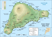
Rano Kau
From the ruins of the ceremonial village of Orongo the cliff face drops to the southwest at an angle of 50° to the sea shore some 300 metres (980 ft) below.
The principal archaeological site on Rano Kau is the ruined ceremonial village of Orongo which is located at the point where the sea cliff and inner crater wall converge.
One ahu with several moai was recorded on the cliffs at Rano Kau in the 1880s, but had fallen to the beach by the time of the Routledge expedition in 1914.
As well as basalt, it contains several other igneous rocks including obsidian (for which it was one of the major sources for the island's stoneworkers) and pumice.
At some point in the early twentieth century, the island's manager took a photograph of steam coming out of the crater wall.