Canton of Redange
It borders the cantons of Wiltz to the north, Diekirch and Mersch to the east, Capellen to the south and Belgium to the west (Province de Luxembourg).
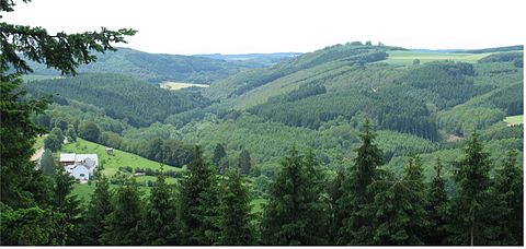
This region is characterised by densely forested hills with an average altitude of 400 to 500m above sealevel, with the highest point being Napoléonsgaard standing at 554m.
Furthermore, there is a high concentration of gas stations linked to fuel tourism along the border with Belgium, in towns such as Haut-Martelange and Oberpallen.
By road, the canton of Redange is linked to various routes nationales, for example the N12 between Luxembourg City and Wiltz, or between Arlon (B) and Ettelbruck.
Furthermore, the canton is covered by an extensive public bus network, which is a part of the Régime général des transports routiers (RGTR).
The mosaic was part of the floor in the entrance hall of a villa rustica and depicts the nine muses alongside the greek poet Homer.
Following multiple territorial reforms, communes were established, and in October 1796 the Département des Forêts was divided into 26 cantons.
During this time, the slate mines of Haut-Martelange accounted for a significant amount of Luxembourg's exports and were a major provider of labour in the region.