Reigate
The earliest archaeological evidence for human activity is from the Paleolithic and Neolithic, and during the Roman period, tile-making took place to the north east of the modern centre.
The economy initially declined in the 18th century, as new turnpike roads allowed cheaper goods made outside the town to become available, undercutting local producers.
The average elevation in the centre is 80 m (260 ft) above ordnance datum (OD) and the area is drained by the Wallace Brook and its tributaries, which feed the River Mole.
[14][15] Reigate Heath and the town centre are on quartz-rich Folkestone Beds[16] and the water-filled part of the castle moat is dug into narrow band of clay present in the sandstone.
[21] Seams of silver sand which occur in the Folkestone Beds were quarried for glass making and the caves beneath the castle may originally have been excavated for this purpose, before being used as cellars.
To the north of the town are the remains of several old chalk pits[24] and lime is thought to have been produced at a site at the base of Colley Hill, although the age of the workings is uncertain.
[37] Excavations in Church Street in the late 1970s uncovered a Saxon glass jar and remains of a skeleton of uncertain age,[38] but archaeological evidence from this period elsewhere in the town is sparse.
The settlement included two mills worth 11s 10d, land for 29 plough teams,[note 3] woodland and herbage for 140 swine, pasture for 43 pigs and 12 acres (4.9 ha) of meadow.
[47] Reforms during the Tudor period reduced the importance of manorial courts and the day-to-day administration of towns such as Reigate became the responsibility of the vestry of the parish church.
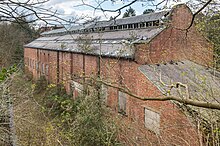
Much of the masonry was most likely removed for local construction projects, but in around 1777, Richard Barnes, who rented the grounds, built a new gatehouse folly using the remaining stone.
[63] Although the exact layout is uncertain, the buildings are thought to have been arranged around a central square cloister, with the church on the north side and the refectory on the south.
[69] Following Ireland's death in 1780, the priory passed through a succession of owners, including Lady Henry Somerset, who remodelled the grounds between 1883 and 1895, creating a sunken garden.
[71] The final private owner of the house was the racehorse trainer, Peter Beatty, who sold it to the Mutual Property Life and General Insurance Company, which relocated from London for the second half of the Second World War.
[75] The manor of Reigate was responsible for maintaining the roads in the local area, but repairs were carried out infrequently[77] and improvements were often only funded by private donations.
The inefficiency created by this division resulted in frequent complaints and court cases relating to the poor state of the roads[77] and so, in 1691, local justices of the peace were given the role of appointing the surveyors.
The new road took the form of a bridleway, laid alongside the existing causeway between the River Mole crossing at Sidlow and Horse Hill, and was unsuitable for wheeled vehicles.
[96] From the early 17th century, the manor began to specialise in the production of oatmeal for the Royal Navy, possibly due to the influence of Admiral Charles Howard, who lived at the priory.
[106][note 14] In 1793, over half of the traffic on the Reigate Hill turnpike was bound for the south coast and numbers swelled as a result of troop movements during the Napoleonic Wars.
[115] Although little fighting took place in Surrey during the Civil War, the Reigate Hundred was required to provide 80 men for the Parliamentarian army, but a force of only 60 was raised, including a captain and lieutenant.
[116] The Royalist, Henry Rich, 1st Earl of Holland, raised a fighting force and marched from Kingston to Reigate where his men plundered local property and briefly occupied the half-ruined castle.
Parliamentary troops under Major Lewis Audley were sent to confront Rich, but he withdrew first to Dorking and then the following day back to Kingston.
Members of the London's Own Territorials were billeted locally whilst undergoing training in the area[118] and Reigate Lodge was used as an Army Service Corps supply depot.
[155][note 17] The first sewerage system in Reigate was installed in 1876 and included a main outfall sewer running under Bell Street via Woodhatch to the treatment works at Earlswood Common.
[155][158] Initially it was contracted to supply gas for 28 street lights in the town centre, but by 1860, increasing domestic demand necessitated the opening of a larger facility at the north end of Nutley Lane.
[181] The Greensand Way, a 108 mi (174 km) long-distance footpath from Haslemere, Surrey to Hamstreet, Kent, passes through Reigate Park to the south of the town centre.
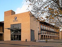
[198] The main building, constructed in 1927, was previously occupied by the Reigate County School for Girls and was designed by the architecture firm Jarvis and Porter.
There are several 17th- and 18th-century monuments inside the church, the largest of which is a memorial to Richard Labroke (d. 1730) who is depicted in Roman dress, flanked by the figures of Justice and Truth.
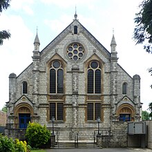
[217][218] St Mark's Church, in Alma Road, was opened in 1860 to serve a new area of housing, under construction to the north of the railway station.
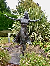
[237] Among the works of public art in the town is a statue of the ballet dancer, Margot Fonteyn, by the artist Nathan David, which was installed at the south end of London Road in 1980.
[284] The southern part of Priory Park was purchased by Randal Vogan in 1920, who donated the land to the Borough Council "to be preserved in its natural beauty for the use and quiet enjoyment of the public".