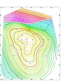
Reservoir modeling
A coarser grid for the reservoir simulation model is constructed, with perhaps two orders of magnitude fewer cells.
The process is successful if the model accurately reflects the original well logs, seismic data and production history.
Reservoir models are constructed to gain a better understanding of the subsurface that leads to informed well placement, reserves estimation and production planning.
Models are based on measurements taken in the field, including well logs, seismic surveys, and production history.
[2] Seismic to simulation enables the quantitative integration of all field data into an updateable reservoir model built by a team of geologists, geophysicists, and engineers.
[3] Well logs are measured in depth and provide high resolution vertical data, but no insight into the inter-well space.
Seismic are measured in time and provide great lateral detail but is quite limited in its vertical resolution.
Based on an understanding of how the area was formed over time, geologists can predict the types of rock likely to be present and how rapidly they vary spatially.
As different geologic structures are encountered, the sound wave reflects and refracts as a function of the impedance contrast between the layers.
Calculations are performed following a number of rock physics algorithms including: Xu & White, Greenberg & Castagna, Gassmann, Gardner, modified upper and lower Hashin-Shtrikman, and Batzle & Wang.
Deterministic inversion techniques are used to provide a good overall view of the porosity over the field, and serve as a quality control check.
Each PDF describes a particular input data in geostatistical terms using histograms and variograms, which identify the odds of a given value at a specific place and the overall expected scale and texture based on geologic insight.
Following geostatistical inversion and in preparation for history matching and flow simulation, the static model is re-gridded and up-scaled.
[6] The static model built from seismic is typically orthogonal but flow simulators expect corner point grids.
Converting directly from orthogonal to corner point can cause problems such as creating discontinuity in fluid flow.
A representative set of the model realizations from the geostatistical inversion are history matched against production data.