Aviator Glacier
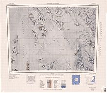
The Aviator Glacier (73°50′S 165°03′E / 73.833°S 165.050°E / -73.833; 165.050) is a major valley glacier in Antarctica that is over 60 nautical miles (110 km; 69 mi) long and 5 nautical miles (9.3 km; 5.8 mi) wide, descending generally southward from the plateau of Victoria Land along the west side of Mountaineer Range, and entering Lady Newnes Bay between Cape Sibbald and Hayes Head where it forms a floating tongue.
An attempt to reconnoiter it by helicopter and to land a party of the New Zealand Geological Survey Antarctic Expedition (NZGSAE) on it had to be abandoned when USS Glacier was damaged in pressure ice in December 1958.
[1] The Aviator Glacier forms on the plateau of Victoria Land and flows in a generally southward direction along the west side of Mountaineer Range.
The Astronaut glacier forms to the south of Evans Névé and to the west of Retreat Hills and Mount Gobey.
Named by the northern party of NZGSAE, 1962–63, to commemorate the air support provided by United States Navy Squadron VX-6, and in association with Aviator Glacier.
A broad southwest flowing tributary to upper Aviator Glacier, joining the latter just west of Parasite Cone.
Named by the northern party of NZGSAE, 1962–63, in recognition of services rendered by pilots of United States Navy Squadron VX-6 in Antarctica, and in association with Aviator Glacier.
A small group of hills 6 nautical miles (11 km; 6.9 mi) southeast of the Intention Nunataks, at the west side of the head of Astronaut Glacier.
So named by the Northern Party of NZGSAE, 1962–63, which had hoped to visit the hills, but was forced to beat a hasty retreat due to blizzards.
The highest mountain, 3,125 metres (10,253 ft) high, in the Retreat Hills, at the south margin of Evans Névé.
[1] This article incorporates public domain material from websites or documents of the United States Geological Survey.