Rio Grande Trail
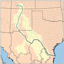
The river also flows through or beside numerous spectacular and geologically interesting landforms, the result of extensive volcanism and erosion of the valley within the Rio Grande Rift.
Informal trails exist on ditchbanks of local acequias and irrigation districts, on abandoned rights-of-way of old railroads, and on some publicly owned land.
Most notable of these are the 16-mile (26 km) Paseo del Bosque Trail, and the abandoned right-of-way of the Chili Line[5] of the Denver and Rio Grande Western Railroad (San Luis Valley Route).
[1] The Mid-Region Council of Governments (MRCOG), the regional planning group for Albuquerque and its surrounds, decided to extend the trail north to Bernalillo and south to Belen, about 40 miles (64 km) in all.
This was determined in part due to the potential for synergy with established state parks and ongoing trail development projects.
[7] North of Bernalillo to NM 502 (connecting Pojoaque and Los Alamos), the Rio Grande passes through several pueblos and White Rock Canyon.