Rio Hondo (California)
Above Irwindale, its main stem is known as Santa Anita Creek, which extends to another 10 miles (16 km) northwards into the San Gabriel Mountains where the source, or headwaters, of the river are found.
Here, both rivers are impounded by the Whittier Narrows Dam, which the Army Corps of Engineers describes as, "the central element of the Los Angeles County Drainage Area (LACDA) flood control system".
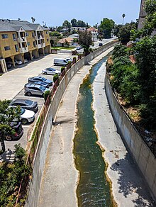
[5] Most of the Rio Hondo is a concrete-lined channel to serve its primary flood control function, but in two places the river flows over open ground: the Peck Road Water Conservation Park, and the Whittier Narrows Recreation Area.
El Rancho de Don Daniel encompassed riparian wetlands and ponds surrounding the Rio Hondo, which flowed year-round, and the seasonal Mission Creek.
With few opportunities for respite after toiling in the fields, Mexican-American residents of the local barrios cultivated recreational lifestyles around this section of the river and embraced it as a bucolic resource for community and family activities.
The northern end starts along the reservoir at the Peck Road Water Conservation Park and continues along the channel to Whittier Narrows Recreation Area.