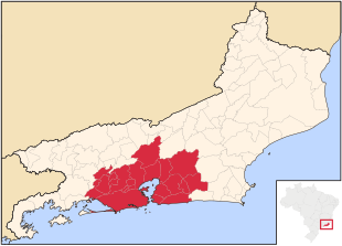
Greater Rio de Janeiro
The metropolitan area of Rio de Janeiro is known as a historical, cultural and economic centre of Brazil, with a total population of 12 million inhabitants.
The region was first officially defined on July 1, 1974, less than 1 year before the fusion of Guanabara into Rio de Janeiro.
Several municipalities show a high level of conurbation, with Rio de Janeiro–Baixada Fluminense and Niterói–São Gonçalo being the most clear examples.
The water supply plans of the region are coordinated, and transportation in the area is heavily interconnected with urban intermunicipal buses to all municipalities in the area, trains over the capital to some Baixada Fluminense municipalities, ferry boats to some of the Guanabara Bay municipalities and major inter-city freeways such as the Rio–Niterói Bridge, Red Line, President Dutra freeway and the Niterói-Manilha freeway (pt).
Most transportation methods are integrated with the capital inner-transportation system of buses, trains, metro, freeways and expressways.