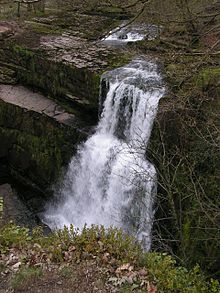
River Mellte
The river derives its name from 'mellt' - the Welsh word for 'lightning' - after its tendency to rise and fall rapidly in response to heavy rainfall.
The entire river runs underground for 1/2 km at Porth yr Ogof as it crosses the Carboniferous Limestone outcrop.
It is a complex maze of passageways, large and small, mostly developed along one or two major bedding planes.
[1] The larger part of the river and its valley is protected both as a site of special scientific interest (Dyffrynoedd Nedd a Mellte a Moel Penderyn SSSI) and as a special area of conservation (Coedydd Nedd a Mellte SAC) in respect of the bryophyte flora which the deep and wooded nature of the valleys help to support.
Brecon Beacons National Park Authority has worked in conjunction with the Forestry Commission and the Countryside Council for Wales, and subsequently with their successor body Natural Resources Wales, to ensure that the path erosion that has resulted from the popularity of this area is halted and reversed.