River Wandle
With a total length of about 9 miles (14 km), the river passes through the London boroughs of Croydon, Sutton, Merton and Wandsworth, where it reaches the Thames.
The occasional stream, known as the Bourne, which runs through the Caterham valley (and Smitham Bottom in Coulsdon) is a source of the River Wandle but only surfaces after heavy rainfall.
[4] However, as Croydon's population grew and use of the water closet increased, the Old Town streams became little more than open sewers and were filled in or culverted from 1840 after outbreaks of typhoid and cholera.
[6] For part of its length, the Wandle forms the boundary between the London Boroughs of Croydon and Lambeth and, further downstream bounds Merton and Wandsworth.
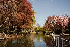
Localities adjoining the river and its mentioned main tributaries include: Croydon, Waddon, Beddington, Wallington, Carshalton, The Wrythe, Hackbridge, Mitcham, Ravensbury, St Helier, Morden, Merton Abbey, Colliers Wood, South Wimbledon, Summerstown, and Wandsworth.
Honeywood Museum, in Carshalton Village, includes displays and an interactive map about the River Wandle and its influence on the life of the area.
[7] Rain falling on part of the North Downs mainly filters through a thin topsoil into chalk and emerges on the spring line and in gentle ravines carved by water erosion.
At the top of the catchment, the Wandle has four main headwaters historically noted as winterbournes — streams which only flow when the water table is high.
The Wandle is piped part-way-through neighbouring New South Quarter to flow under Purley Way (formerly Waddon Marsh Lane) and part of its retail park.
On its route the early Wandle surfaces to receive springs at a long lake Waddon Ponds beside Mill Lane, Croydon.
Local concentration of heavy industry resulted in multiple leats being cut during the 18th century; a remnant of the old courses, the Pickle, is two ditches, one running beneath Liberty Avenue.
This improvement in water quality has also seen other fish thrive with stocks of chub, roach and dace all flourishing once again with the most popular angling spots being in Hackbridge and Colliers Wood.
[citation needed] A stretch of the river between Trewint Street and Plough Lane in Merton has been designated as the Lower Wandle Local Nature Reserve (LNR).
[13][14] In 2017, a new nature reserve was created in Bell Lane Creek at the confluence of the Wandle and the Thames, by removing a half-tide weir that had been installed in the 1980s.
[19] In 2010 a High Court judge found the fine was under the statutory rules governing pollution penalties "manifestly" excessive, reducing it to £50,000, noting Thames Water had donated £500,000 to clean up the river.