Yala River
It generally flows fast over a rocky bed through a wide valley before joining the Nzoia River to form the Yala Swamp on the border of Lake Victoria.
It flows west for 219 kilometres (136 mi) to its mouth on Lake Victoria in Siaya County, Kenya.
[1] It is one of the largest Kenyan rivers feeding Lake Victoria, with an average discharge of 27.4 cubic metres per second (970 cu ft/s).
[3] The Yala River flows through a wide, mature valley that appears to have been rejuvenated during the tilting associated with the rifting movements of the mid-Pleistocene.
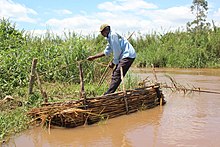
[5] The Yala Swamp at the mouth of the river covers about 175 square kilometres (68 sq mi) along the northern shore of Lake Victoria.
[1] An ecosystem management study of the Yala and Nzoia river basins issued a baseline report in 2008.
The farms are managed better in the north of the block, with more trees and hedges, while in the southern part steep slopes are cultivated with no conservation measures.
[21] As of 2016 a feasibility study had been completed for development of the Nandi Forest dam to support irrigation, water supply and power generation.
[22] In April 2020 it was announced that Tembo Power of Mauritius, along with Metier and WK Construction of South Africa had signed an agreement for development of a run-of-the-river hydroelectricity plant on the Yala River.
[1] Development potential includes irrigation and drainage projects in the lower and middle parts of the basin, hydroelectricity, wetlands products, eco-tourism and water sports tourism, and perhaps carbon sequestration.
Sufficient wetlands must be maintained to control erosion and improve water quality, which in turn affects fisheries in the river and the adjacent lake.
It recommended an inclusive management plan for the Yala swamp complex to prevent further degradation of the ecosystem.