Robert-Bourassa generating station
[3] Initially known as La Grande-2, it was renamed after Robert Bourassa who, as Premier of Quebec (1970–1976 and 1985–1994), gave the James Bay Project a vital political impetus.
Design work on the generating station, dam and reservoir began in October 1970 when Montreal-based engineering firm Rousseau Sauvé Warren (RSW) was commissioned by Hydro-Québec to prepare a feasibility study for a hydroelectric complex on the La Grande River.
Another engineering firm, Asselin, Benoît, Boucher, Ducharme & Lapointe (ABBDL) was tasked with a feasibility study on the more southerly NBR (Nottaway, Broadback, Rupert) rivers.
At RSW the development of the La Grande River was championed by François Rousseau, one of firm's associates and a former Hydro-Québec senior engineer.
The La Grande option had the added advantages of a lesser impact on First Nations hunting and fishing, on the boreal forest and would require less flooding.
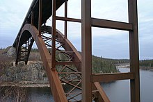
[5] The main dam is located 117.5 kilometers (73.0 mi) from the mouth of the river, in the transition zone between the plateau and the coastal plain, and has a maximum height of 162 meters (531 ft).
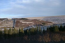
The dam and dykes hold a reservoir covering an area of 2,835 square kilometres (1,095 sq mi) with a useful capacity of 19.365 billion m³.
[7] In 1974, in what was one of the most extreme cases of workplace sabotage up to that time, workers at the La Grande-2 site used bulldozers to topple electric generators, damage fuel tanks, and set buildings on fire.
The causes were not clear, however three factors have been cited: inter-union rivalry, poor working conditions, and the perceived arrogance of American executives at the contractor, Bechtel Corporation.
Engineering firm Desjardins, Sauriol and Associates were tasked with the construction of a basic road to the future site and the Cree settlement at Fort George.
After the dam was completed, the tunnels are still used as flood control outlet works and have a design flow of 3,100 cubic metres per second (110,000 cu ft/s).
The Robert-Bourassa dam is located 117.5 kilometres (73.0 mi) from the mouth of the La Grande River, in the transition zone between the Laurentian Plateau (the elevated Canadian Shield) and the coastal plain.
Covering an area of 2,835 square kilometres (1,095 sq mi) – greater in size than Luxembourg – the vast Robert-Bourassa Reservoir is fed by an upstream catchment of 32,480 square kilometres (12,540 sq mi), plus water diversions from the James Bay Project, the Caniapiscau Reservoir and the EOL (Eastmain-Opinaca-La Grande) diversion project.
To prevent the flooding of an additional 30 square kilometres (12 sq mi) and preserve the lake in its natural state, a pump station was installed which removes water from the Dessaulniers to the Robert-Bourassa Reservoir.
The pump station was designed to remove an annual average of 2.8 cubic metres per second (99 cu ft/s), from a drainage area of 160 square kilometres (62 sq mi).
The underground complex, including a service tunnel, the generation room and a surge chamber, required the excavation of 2,350,000 cubic metres (83,000,000 cu ft) of material.
The plant has 16 Francis turbines, divided into two sets of eight each, and separated by a mounting area, workshops, control room, elevator shaft and ventilation system.