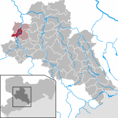
Rochlitz
349 m (NHN)) is of Rotliegend volcanic origin (latest Carboniferous to Guadalupian) and consists to a large extent of so-called Rochlitzer Porphyr, a rhyolitic tuff or ignimbrite.
Due to its colour and structure, this rock is used in representative buildings in the wider region like the Old Town Hall in Leipzig and is mined in deep quarries.
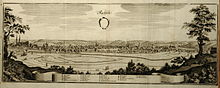
[3] A market settlement below Rochlitz Castle and east of St Peter's church, near today's square Mühlplatz, formed presumably in the 11th century, likely connected with a ford across the Zwickauer Mulde near the village of Zaßnitz.
The approximate founding date is supported by archeological findings and preserved Romanesque architectural features of the church which originated in a short basilica without transept.
St. Cunigunde's church was rebuilt in late Gothic style from 1416 to 1476, and obtained a new altar, carved in wood, in 1513.
The central part of the former lower market square (east of today's town hall) was built over in the first half of the 16th century (Mittelzeile).
The travelling barber-surgeon and oculist Johann Andreas Eisenbarth plied his trade in Rochlitz in early 1691.
Reconstruction after a fire in 1802 changed the appearance of the town significantly with new residential buildings and a new tower of St Cunigunde's church (1804).
The Nazi Party managed early to establish themselves in the town council, and in 1934 they deposed the non-partisan mayor by means of a political intrigue.
On the initiative of the president of the local historical society and honorary director of the museum, Albert Bernstein, celebrations were held in 1936 ostensibly in honour of the 1000th anniversary of German control of the Rochlitz area (a mere historical construct), but in reality as a means of attracting business and tourism.
During World War II, a subcamp of Flossenbürg concentration camp was located in the town from September 1944 to March 1945.
Until the Americal withdrawal on 30 June 1945, the Zwickauer Mulde was part of the demarcation line between the American and Soviet occupied territories.
By government order of 22 June 1816 the town became the seat of Amt Rochlitz within the IInd Amtshauptmannschaft (district) of Kreishauptmannschaft (administrative region) Leipzig.
Name and territory of Landkreis Rochlitz changed, when in 1952 the government of the GDR dissolved the federal states and replaced them by Bezirk|Bezirke, and the subdivision in districts was reformed.
According to the oldest surviving documents judiciary documents from 1436, the town council possessed the right to execute higher and lower justice, and held the rights to patrimonial justice in the so-called Ratsdörfer (villages subjected to the council) Köttern, Poppitz, and Spernsdorf.
The courts of justice for the town and the villages were joined in 1856 into a single judiciary office (Justizamt, formed in 1856, then Gerichtsamt), that was succeeded by Amtsgericht Rochlitz in 1879.
The communal elections in Saxony on 25 May 2014 resulted in the following distribution of seats in the town council:[10] Voter turnout was 50.8%.
The historical configuration of the town, consisting of a market square with surrounding buildings, but without a network of streets, is rare for Saxony.
The neoclassicist town hall from 1828 forms the eastern termination of the market square with its patrician houses.
The observation tower on Rochlitzer Berg was built in 1860 from the local "porphyry" stone and is named after King Frederick Augustus II of Saxony.
[13] In 1889 a farmer from Zaßnitz on the opposite bank of the river had built a bridge suspended from a rope and charged a fee for its usage.