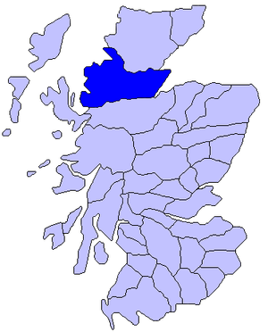
Ross, Scotland
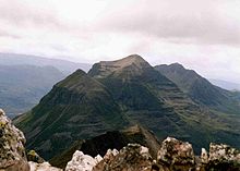
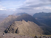
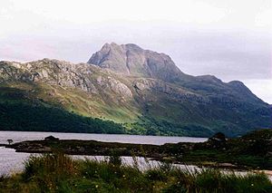
Wester Ross is sparsely populated, containing part of the Northwest Highlands mountains and having extensive sea lochs along its coast onto the Minch.
Ptolemy's 2nd century Geography lists a tribe called the Decantae occupying the area that would later become Easter Ross.
In Roman times, and for long afterwards, the land was occupied by Picts, who, in the 6th and 7th centuries, were converted to Christianity by followers of Saint Columba.
Throughout the next three centuries the natives were continually harassed by Norwegian Viking raiders, of whose presence tokens have survived in several place-names (Dingwall, Tain, and others).
At this time the country formed part of the Province of Moray (Latin: Moravia), which then extended as far as the Dornoch Firth and the River Oykel.
The principal relics of antiquity - mainly stone circles, cairns and forts - appear in the eastern district.
Some fine examples of sculptured stones occur, especially those that, according to tradition, mark the burial-place of the three sons of a Danish king who were shipwrecked off the coast of Nigg.
[2] On the top of the cross in Nigg churchyard are two figures with outstretched arms in the act of supplication; the dove descends between them, and below are two dogs.
After the battle, the people of Ross embraced Donald and Mariota as rightful rulers of the earldom notwithstanding the Duke of Albany (a Stewart) purporting to give it to his son.
In consequence, however, of the treason of John Macdonald, 4th and last Lord of the Isles and 12th Earl of Ross, the earldom was again vested in the crown (1476).
The Rosses held what is now Easter Ross; the Munros the small tract around Ben Wyvis, including Dingwall; the Macleods Lewis, and, in the mainland, the district between Loch Maree and Loch Torridon; the Macdonalds of Glengarry, Coigach, and the district between Strome Ferry and Kyle of Lochalsh, and the Mackenzies the remainder.
[8][9][10] Apart from occasional conflicts between rival clans, the only battles in the county were at Invercarron, at the head of Dornoch Firth, when Montrose was crushed by Colonel Archibald Strachan on 27 April 1650; and at Glenshiel, where the Jacobites, under the Earl of Seaforth, aided by Spaniards, were defeated by a force under the command of General Joseph Wightman on 10 June 1719.
The River Blackwater flows from mountains in Strathvaich southeast for 18 mi (29 km) until it joins the Conon, forming soon after it leaves Loch Garve the small but picturesque Falls of Rogie.
Within a short distance of its exit from Loch Luichart the Conon pours over a series of cascades and rapids and then pursues a winding course of 12 mi (19 km), mainly eastward to the head of the Cromarty Firth.
The stream giving rise to them drains a series of small lochs on the northern flanks of Beinn Fhada (Ben Attow) and, in an almost unbroken sheet over a metre in width, effects a sheer drop of 110 m, and soon afterwards ends its course in Glen Elchaig.
12 miles south-east of Ullapool, on the estate of Braemore, are the Falls of Measach, formed by the Droma, a headstream of the River Broom.
Of the straths or valleys, the more important run from the centre eastwards, such as Strathconon, Strathbran, Strathgarve, Strathpeffer and Strathcarron.
In the extreme south Glen Shiel runs between five mountains (the Five Sisters of Kintail) to its mouth on Loch Duich.
The western boundary of the younger schist is formed by the great pre-Cambrian dislocation line that traverses the county in a fairly direct course from Elphin on the north by Ullapool to Glencarron.
The Torridonian rocks are succeeded unconformably by a series of Cambrian strata confined to a variable but narrow belt west of the line of main thrusting.
So great has been the disturbance in the region of thrusting that in some places, as in the neighborhood of Loch Kishorn and elsewhere, the rocks have been completely overturned and the ancient gneiss has been piled upon the Torridonian.
On the shore of Moray Firth at Rathie a small patch of Kimeridge shale occurs, and beneath the cliffs of Shandwick there is a little Lower Oolite with a thin seam of coal.
The most fertile tracts lie on the eastern coast, especially in Easter Ross and the Black Isle, where the soil varies from a light sandy gravel to a rich deep loam.
Most of the horses, principally half-breds between the old garrons (hardy, serviceable, small animals) and Clydesdales, were maintained for the purposes of agriculture.
Red and roe deer abounded, and foxes and alpine hares were common, while badgers and wild cats were occasionally trapped.