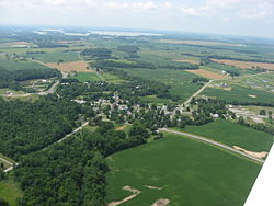
Roundhead, Ohio
[1] The first Euro-American settlement at Roundhead was made in 1832 on the site of a former Wyandot Indian village.
[5] An archaeological site, the Zimmerman Kame, is located in the Roundhead vicinity; it is listed on the National Register of Historic Places.
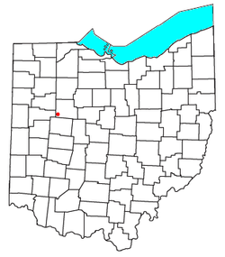
[6] Located at an altitude of 1,004 feet (306 m),[4] it sits at the intersection of State Routes 117, 235, and 385, 2.75 miles (4.43 km) north of the northeast corner of Indian Lake and 13 miles (21 km) southwest of the city of Kenton,[7] the county seat of Hardin County.
[10] Besides its post office, the community includes a Park, a volunteer fire department,[11] a United Methodist Church, a restaurant/bar, and two cemeteries.
This Hardin County, Ohio state location article is a stub.