SUPARCO
[4] Its initial objective was to learn rocketry and high altitude research from the United States, which ultimately led to the development of a national satellite program.
[8][9] The agency has sustained significant criticism within Pakistan for failing to compete with its Indian and Chinese counterparts in terms of capabilities in spite of being established earlier than them.
[10][11][12] The past federal ministries of Pakistan initially avoided to fund the space program and engineering education in spite of opportunity available from the United States.
Collaborations with the Pakistan Radio Society (PRS) and the University of Surrey in England enabled SUPARCO to participate in satellite engineering projects, contributing to the development of UoSAT-1 and UO-11, which were launched in 1984.
: 24 [28] The PakSAT program was originally designed to develop the television receive-only (TVRO) terminals for the receptions of news, entertainment, and educational channels from direct broadcasting satellite dishes.
[32] Every year, SUPARCO sponsors and organizes the World Space Week (WSW) to promote the understanding of the Earth science all over the country.
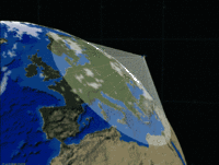
[35] SUPARCO operates a national balloon launching facility in Karachi to conduct studies in atmospheric sciences to determine the vertical profile of ozone up to 30–35 km.
[36] This balloon sounding facility has been extensively used for carrying out research in better understanding of the meteorology and how the ozone layer vary seasonally in the stratosphere and troposphere.
[38] The program's mainstream objective and aim is to conduct research studies for the advancement and better understanding of the theoretical physics, astronomy, astrophysics, and mathematics involving the three-dimensional universal space and time.
This program explores vast topics like quantum mechanics, deep space objects, dark matter and energy, supernovae, nebulae, and galaxies.
[42] SUPARCO regularly publishes a public domain bulletin of geomagnetic data, which includes research on the effects of solar flares and severe magnetic storms recorded by the observatories.
It has established a Ground Based Augmentation System (GBAS) on a proof of concept basis to provide correction signals to authorized users.
Additionally, SUPARCO has deployed a Space Based Augmentation System (SBAS) via PakSAT-MM1 to cater to the specific needs of aviation, marine, and land users who require high-integrity correction signals.
In 1990, the Government of Pakistan accorded approval for SUPARCO's participation in the Cospas program as ground segment provider and lead space station with close coordination with the Soviet Union.
Over the years, the mission control center has equipped itself with advanced technology and is capable of distributing distress alert data to rescue coordination centres in the country.
[44] SUPARCO has been a pioneer in introducing Remote Sensing/GIS and allied technologies in Pakistan, providing turnkey solutions and services to diverse users across various fields.
These applications range from agriculture and forestry to disaster management, water resources, environmental monitoring, urban planning, and coastal and marine studies.
The agency maintains active membership in several international organizations, institutes, scientific committees and United Nations bodies like UNCOPUOS, UN-SPIDER, UN-ESCAP, COSPAR, IAF, ISPRS, APSCO etc.
[63] The Scientific and Technological Research Council of Turkey and Turkish Aerospace Industries's senior ranking officials and representative signed a separate accord with the SUPARCO to enhance the cooperation in the satellite development program.