Sagaing Fault
It links the divergent boundary in the Andaman Sea with the zone of active continental collision along the Himalayan front.
It passes through the populated cities of Mandalay, Yamethin, Pyinmana, the capital Naypyidaw, Toungoo and Pegu before dropping off into the Gulf of Martaban, running for a total length of over 1200 kilometers.
In 1913, Thomas Henry Digges La Touche of the Geological Survey of India[3] acknowledged the existence of a plate boundary feature along the Shan Plateau's western margin in Mandalay, including the one dividing metamorphic stratas of the Sagaing Hills from the Central Tertiary Basin.
While analysing historical earthquakes in Myanmar, Harbans Lal Chhibber (1934) discovered a linear trace when joining their epicenters which he inferred to be along the same fault.
[4] In 1970, Aung Khin and others confirmed the fault's existence using geophysical techniques and a Bouguer gravity investigation from Taungoo to Thabeikkyin.
He also made the first description of the fault in Rift features at the Sagaing Tagaung Ridge at the Fifth Burma Research Congress.
He determined the fault running nearly the entire length of Myanmar from south to north had a strike-slip mechanism, and linked it to historical earthquakes.
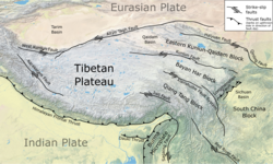
[5] The Sagaing Fault begins offshore in the Andaman Sea at a divergent boundary before passing through the central Myanmar basin.
The total slip rate across the Indian–Sunda plate boundary is about 35 mm/yr, of which 18 mm/yr is accommodated by the Sagaing Fault, according to GPS data.
[9][10] The southern section comprises, from south to north, the Bago, Pyu, Naypyidaw, Meiktila and Sagaing segments.
The 170 km (110 mi) Bago segment runs from Myanmar's coast, southeast of Yangon, to 18°N, where the fault experiences a sharp bend.
The trace is no longer visible at 24°N where a left stepover leads to the Ban Mauk segment 10 km (6.2 mi) west.
Due to the rarity of clear geomorphic offsets associated with this segment, its slip rate is inferred to be low.
The segment marks the boundary between the Neogene volcanics of the west and Miocene sedimentary strata of the east.
Right-lateral displacements are also well-expressed in drainage channels on the eastern flank of the Naga Hills at its northern termination.
The great 1839 Ava earthquake killed hundreds and damaged many cities, including the then imperial capital Inwa.
The first earthquake—which was followed-up by subsequent larger events—struck southwest of Nay Pyi Daw, and east of Thayetmyo in the Pegu Range in August 1929.
[13] There are insufficient reports of damage caused by this earthquake, although it was said that buildings were swaying and objects were displaced at Yamethin, roughly 133.6 km north of the quake epicenter.
On the night of May 5, a large shock registering Mw 7.5 struck north of the city of Pegu resulting in widespread deaths and destruction.
[16][17][18] Violent shaking from an Mw 7.3 earthquakedisrupted the early morning of December 4 in Pyu, Taungoo District.
[22] The largest earthquake in the sequence, an Mw 7.6 quake, struck next to Indawgyi Lake, resulting in large landslides and ground failures.
Looking back at the historical records of earthquakes, the years 1906 and 1908 saw two major events in the northernmost end of the Sagaing Fault.
The centroid moment tensor solution suggested the earthquake ruptured a north–south trending and sub-vertical fault that steeply dipped to the east.
The Sagaing Fault's relatively straight geometry, the longest continuous observed worldwide, could sustain supershear ruptures.
[27] The length of fault running 260 km (160 mi) from 19.2°N to 21.5°N, on the Meiktila segment, is designated a seismic gap due to the absence of major earthquake ruptures since at least 1897.
Another seismic gap running 180 km (110 mi) lies in the Andaman Sea south of Yangon, potentially generating a magnitude 7.7 earthquake.