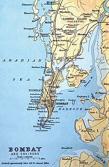
Salsette Island
Both suburbs are separated by the Borivali National Park till the neighbourhood of Powai in Andheri.
[3] It was inhabited by (Aagri, Kunbi) farmers, agriculturists, (Bhandaris) toddy tappers, (Sutar, Malis) artisans and (Kolis) fisherfolk who trace their conversion to Christianity back to 55 AD with the arrival of Christ's disciple, Bartholomew the Apostle, in north Konkan region.
They were later converted to the Latin Church in India by four religious orders—the Dominicans, Franciscans, Augustinians & Jesuits— who arrived in the 15th century with the Portuguese.
[4] 109 Buddhist caves, including those at Kanheri, can be found on the island, and date from the end of the 2nd century.
In 1554, the islands were handed over to Garcia de Orta, a renowned physician and botanist and the author of Colloquies on the Simples Drugs and Medical Matter of India, a seminal work on Indian Eastern medicine of its time.
In 1661, the seven Bombay (Mumbai) islets were ceded to Britain as part of the dowry of Catherine de Braganza to Charles II of England; while Salsette remained in Portuguese hands.
Charles II in turn, leased the Bombay islets to the English East India Company in 1668 for £10 per year.
The company found the deep harbour at Mumbai (Bombay) eminently apposite, and the population rose from 10,000 in 1661 to 60,000 by 1675.
Marquis de Pombal formally ceded what would become Greater Bombay, to Peshwa Balaji Bajirao of the Mahratta Confederacy in the 1750s.
The British occupied Salsette in 1774,[6] and it was formally ceded to the East India Company in the 1782 Treaty of Salbai.
Railway viaducts and causeways were built in the 19th century to connect Bombay Island to the mainland via Salsette.
[9] These railway lines and roads encouraged wealthier merchants to build villas on Salsette.
These included Bandra, Khar Danda, Juhu (an old linear sand bar rising above sea level by just a metre or two), Versova, Marve Island, Dharavi Island and Rai Murdhe, all with a knoll core and fringing wave-cut platforms and sandy beaches.
The highest point is the conical peak of Kanheri (467 metres) in Borivali National Park on the northern reaches of the island.
North of this region lie vast amounts of protected wetlands at Sewree, home to migratory birds.