San Pedro River (Arizona)
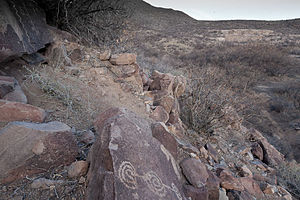
The first Europeans to visit the San Pedro River may have been the parties of Cabeza de Vaca, Fray Marcos de Niza or the Coronado expedition, and while no archeological evidence as yet exists of the passing of these groups, it has been fairly firmly established that the upper San Pedro was a widely recognized and utilized leg of the "Cibola Trail.
[8] It is widely believed that by 1762 Apache depredation drove the Sobaipuri and Spanish out of the San Pedro Valley which then remained largely uninhabited until the early 1800s.
The battalion's presence had aroused curiosity among a number of wild cattle, and the bulls of these herds damaged wagons and injured mules.
[13] In the 19th century the river was a meandering stream with fluvial marshlands, riparian forest, Sporobolus grasslands and extensive beaver ponds.
A. Allen described a mammal collection from southeastern Arizona, "On the headwaters of the San Pedro, in Sonora, a colony of a dozen or more had their lodges up to 1893, when a trapper nearly exterminated them.
[citation needed] By the mid-20th century the once perennial river only flowed during the rainy season and beaver, fluvial marshlands and Sporobolus grasslands were uncommon.
[19] The San Pedro River is the central corridor of the Madrean Archipelago of "Sky Islands", high mountains with unique ecosystems different from the ecology of the Sonoran desert "seas" that surround it.
There are also over 65 species of reptiles and amphibians, among them Sonoran tiger salamander (Ambystoma mavortium stebbinsi) and western barking frog (Eleutherodactylus augusti).
The flora includes Fremont cottonwood (Populus fremontii), Goodding willow (Salix gooddingii), velvet mesquite trees, and the Huachuca water umbel (Lilaeopsis schaffneriana spp.
[17] Riparian habitat covers only 1% of the Southwest but supports 50% of breeding bird species and is vital as a food source for migrating avifauna.
[23] Fredlake reasoned that beaver dams would raise the water table, allowing groundwater to recharge the river's flow in the dry season.
[26] The San Pedro drains an area of approximately 4,720 square miles (12,200 km2) in Cochise, Graham, Pima, and Pinal Counties.
The San Pedro is fed by numerous tributaries, which in general, drain relatively short and steep catchments oriented more or less perpendicular to the mainstem.
[27] For most of its length the San Pedro flows over sedimentary basin fill deposits, although it is bound by bedrock at the Tombstone Hills at Charleston and near Fairbank, “the Narrows” south of Cascabel, near Redington, and again at Dudleyville (Heindl, 1952).