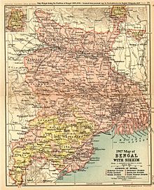
Santhal Pargana division
Presently, this administrative division comprises six districts: Godda, Deoghar, Dumka, Jamtara, Sahibganj and Pakur.
[1] In the system of Permanent Settlement, British encourage paharia of Rajmahal hills to practice settled agriculture but they refused to cut trees.
Then British officials attracted attention to Santals who were ready to clear the forests for settled agriculture.
Santal from Cuttack, Dhalbhum, Birbhum, Manbhum, Hazaribagh migrated, clear forest tracts and started cultivating these lands as peasants.
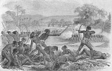
[7] As a consequence of Santal uprising, the British passed the Santhal Parganas Tenancy Act ,1876 which offered some protection for the tribals against exploitation.
It prohibits the sale of Adivasi land to non-Adivasis in the Santal Pargana region along present day Jharkhand's border with West Bengal.