Schoharie Creek Bridge collapse
Six days later, 3.1 mi (5 km) upstream, a large section of the Mill Point Bridge collapsed.
Photos taken the day of the event show that the nose of pier three had fallen relative to its tail, which seemed to remain in position.
Because of the high profile of this catastrophe and loss of life, the National Transportation Safety Board started investigations in the immediate aftermath of the failure.
The New York State Thruway Authority hired a consortium made up of staff from Wiss, Janney, Elstner Associates, Inc., and Mueser Rutledge Consulting Engineers to lead the investigation on their behalf.
The observed failure of the downstream (tail) end of pier two added confusion to the causative analysis.
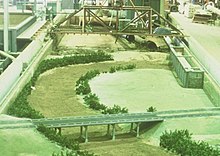
A physical hydraulic model of the regional flow field constructed at a non-distorted scale of 1:50 using clear water and sand bed allowed observation of the failure progression.
As a result, the flow near the bed of the river channel at the bridge opening had an angle relative to the alignment of pier 3.
A second physical hydraulic model constructed at a scale of 1:15 with the appropriate angle of attack relative to the axis of pier 3 allowed detailed phenomenological study of the scour process.
Because of the angle of attack created by the secondary flow, scour preferentially affected the right-hand portion of the pier as eroded bed material swept downstream.
With each successive increment of undermining, which progressed from the nose of the pier towards the tail, the upper portion of the plinth experienced increasing tension.
Evidence from post-event analysis of the dewatered site suggested that undermining of the pier three spread footing was extensive, well in excess of 50 percent of its length, when the plinth suddenly failed.
The simple-span bridge design had no ability to resist the resulting lateral load on the unsupported column, leading to sudden, catastrophic and progressive collapse of both spans supported by pier 3.
[6] The foundation of the pier was bearing on erodible soil, consisting of layers of gravel, sand and silt, inter-bedded with folded and tilted till.
At the time of the collapse, the upstream end of pier 3 fell into a scour hole approximately 9.8 feet (3 m) deep.
Other considerations as to the cause of the collapse included design of the superstructure, quality of materials and construction, and inspection and maintenance.
[7] Twelve hours before the Schoharie Creek Bridge collapsed due to heavy rainfall, the rush of water through the Blenheim-Gilboa Pumped Storage Power Project 40 miles (64 km) upstream hit a historic high.