Sekong province
Unlike most of Laos, there are relatively few Buddhist temples (Wat) seen in the province as the predominant belief system is more oriented to animism and ancestral worship.
Sekong is split administratively into four districts: Thateng on the Bolaven Plateau, Lamam in the lowland plain, and Dakchung and Kaleum in the mountainous areas bordering Vietnam.
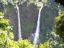
The most famous water fall is the Nam Tok Katamtok that is located on the Huay Katam River, deep in the forests of the Bolaven Plateau.
[8] Sekong is among the most remote areas of Laos;[9] even some of its largest villages are virtually inaccessible by road for at least half of the year.
This isolation has meant that forest cover, biodiversity, and ethnic traditions have changed less in recent years than in other areas in Laos.
The natural forests in the province are also helpful in carbon sequestration benefits estimated to be US$124 per hectare and also in watershed improvements, by way of avoiding erosion and reducing flood incidence.
[12] Corruption in Sekong province is endemic, and it has reportedly "undermined a successful donor-funded village participatory sustainable forest management initiative.
Other fauna include the Oriental small-clawed otter (Aonyx cinerea), tiger (Panthera tigris), big-headed turtle (Platysternon megacephalum), and herds of Asian elephant (Elephas maximus).
The NBCA sits at an altitude of 400–2,066 metres (1,312–6,778 ft) and is 1335 km2 in size; the highest peak is Dong Be with an elevation of 2,066 m, part of the Southern Annamite Mountains.
Its key avifauna includes Blyth's kingfisher (Alcedo hercules), Vietnamese crested argus (Rheinardia ocellata), and yellow-billed nuthatch.
[16] An unpaved road from Salavan to Ta-Oy and further east to Samuoy runs the northern border of Xe Sap NBCA.
But small paths provide approaches from the main road to villages located on the northern part of the NBCA.
Within this broad family, the ethnic groups of Sekong fall into two linguistic branches: the Katuic (including the Katu and the Nge/Krieng) and the Bahnaric (Alak and Tarieng).
Infrastructure is relatively under developed, with few having access to clean water and sanitation as of 2000, and the literacy rate is extremely low.
[20] In June 2020, the Lao government approved a Singapore energy firm's plan to develop a new US$1.7 billion fossil fuel-fired thermal power plant in Sekong province.
Laos has an estimated 600-700 million tons of coal reserves nation-wide, primarily lignite, one of the most heavily polluting fuels.
The second coal-fired, 700 MW plant will be built in La Mam District by a Chinese company that will invest over US$1 billion in the project.
There are several funerary and sacred forests, Indochina War relics, and a stretch of the Ho Chi Minh Trail.
[15] To ward off falling bombs during the Indochina War, some animist tribal people placed a talisman above their huts.
The men of the Talieng ethnic group wrap a Tha Khatil cloth around their waist as a traditional costume.
[23] In addition to geometric stripes, decorative patterns include animals or plants, considered to be traditional motifs, or planes and bombs, which have a historical context.