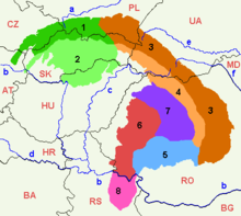
Serbian Carpathians
That part encompasses the southern bank of the Iron Gate and the area of Đerdap National Park.
The extreme points of so defined Carpathian area in Serbia are Tekija 44°43′N 22°28′E / 44.717°N 22.467°E / 44.717; 22.467 in the north, 44°22′N 22°06′E / 44.367°N 22.100°E / 44.367; 22.100 in the south, Golubac 44°40′N 21°36′E / 44.667°N 21.600°E / 44.667; 21.600 in the west and 44°39′N 22°33′E / 44.650°N 22.550°E / 44.650; 22.550 in the east (Iron Gate dam).
[2] The entire part of Serbia east of the Great and South Morava rivers is referred to as "Carpatho-Balkan arc" in geotectonic terminology.
Limestones and dolomites (in a lesser extent) of Jurassic (J2, J3) and Lower Cretaceous (K1+2, K3+4) age whose thickness can be more than 1,000 m. The structures are generally oriented in north–south direction, which bend on northern and southern parts, forming a C-shaped arc.
[3] Though those mountains are related to the Carpathians from the geological point of view, they have been included to them by the scientists only at the end of the 20th century.