Sierra de los Cuchumatanes
The Sierra de los Cuchumatanes, in western Guatemala, is the highest non-volcanic mountain range in Central America.
[1] With an area of 1,500 km2 (580 sq mi) lying above 3,000 m (9,800 ft), it is also the most extensive highland region in Central America.
Its western and south-western borders are marked by the Seleguá River, which separates it from the Sierra Madre volcanic chain.
Its southern border is defined by the Río Negro, which flows into the Chixoy River, which turns northwards and separates the Cuchumatanes from the mountains in the Alta Verapaz region.
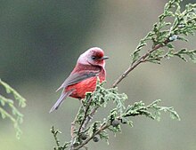
[5] A 300,000 ha site has been designated an Important Bird Area (IBA) by BirdLife International because it supports significant populations of range-restricted and biome-restricted species of the northern Central American and Madrean highlands.
People place small soil islands on the tops of the stone fences to grow plants such as agave.
Many send remittances home to their families, who use the money to buy pickup trucks, build new houses and install irrigation and electricity.