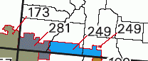
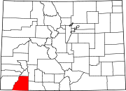
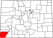
Southern Ute Indian Reservation
[3] The only other community that is recognized as a separate place by the Census Bureau is the CDP of Southern Ute, which lies just southeast of Ignacio.
[4] The Muache ( Moghwachi Núuchi, Mouache, Mahgruhch, Mahgrahch, Muwac) band lived along the eastern foothills of the Rocky Mountains from Denver in the north to Las Vegas, New Mexico, in the south, traded with northern Puebloan peoples, especially with Taos Pueblo, therefore often called Taos-Ute, ranged after adoption of the horse with their allies, the Llanero band of the Jicarilla Apache, southeastward as far as the Texas Panhandle.
The first reservation created by the treaty of 1868 encompassed about 1/3 of present-day Colorado, mostly the mountainous regions west of the continental divide.
[5] In 1895 The Hunter Act distributed the land in the reservation in plots to the heads of households in the Mouache and Capote tribes.
They refused to go back to the old grounds of the agency so they established camps on the western end of the Southern Ute Reservation.
With the three tribes given their land the final provisions of the Hunter Act were implemented opening over 500,000 acres (200,000 ha) of the Reservation to non-native settlers.
[11] The Southern Ute Indian Tribe’s coalbed methane capture project reduced greenhouse gas emissions by the equivalent of about 379,000 metric tons of carbon dioxide between 2009 and 2017.
[12] Conventional coalbed methane production wells were not economically feasible in this location due to the low volume of seepage.