Spanish conquest of the Maya

Maya warriors fought with flint-tipped spears, bows and arrows, stones, and wooden swords with inset obsidian blades, and wore padded cotton armour to protect themselves.

[28] At the time of conquest, polities in the northern Yucatán peninsula included Mani, Cehpech, and Chakan;[25] further east along the north coast were Ah Kin Chel, Cupul, and Chikinchel.

[36] In the centuries preceding the arrival of the Spanish the Kʼicheʼ had carved out a small empire covering a large part of the western Guatemalan Highlands and the neighbouring Pacific coastal plain.

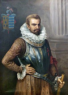
[nb 1] The conquistadors were all volunteers, the majority of whom did not receive a fixed salary but instead a portion of the spoils of victory, in the form of precious metals, land grants and provision of native labour.

[57] Native resistance to the new nucleated settlements took the form of the flight of the indigenous inhabitants into inaccessible regions such as the forest or joining neighbouring Maya groups that had not yet submitted to the Spanish.

[56] Horses had never been encountered by the Maya before,[62] and their use gave the mounted conquistador an overwhelming advantage over his unmounted opponent, allowing the rider to strike with greater force while simultaneously making him less vulnerable to attack.

[75] The Spanish described the weapons of war of the Petén Maya as bows and arrows, fire-sharpened poles, flint-headed spears and two-handed swords crafted from strong wood with the blade fashioned from inset obsidian,[76] similar to the Aztec macuahuitl.

[67] In response to the use of cavalry, the highland Maya took to digging pits on the roads, lining them with fire-hardened stakes and camouflaging them with grass and weeds, a tactic that according to the Kaqchikel killed many horses.

[103] The ship's pilot then steered a course for Cuba via Florida, and Hernández de Cordóba wrote a report to Governor Diego Velázquez describing the voyage and, most importantly, the discovery of gold.

[117] In 1522 Cortés sent Mexican allies to scout the Soconusco region of lowland Chiapas, where they met new delegations from Iximche and Qʼumarkaj at Tuxpán;[118] both of the powerful highland Maya kingdoms declared their loyalty to the King of Spain.

[124] In 1524,[113] after the Spanish conquest of the Aztec Empire, Hernán Cortés led an expedition to Honduras over land, cutting across Acalan in southern Campeche and the Itza kingdom in what is now the northern Petén Department of Guatemala.

[128] Cortés found a village on the shore of Lake Izabal, and crossed the Dulce River to the settlement of Nito, somewhere on the Amatique Bay,[131] with about a dozen companions, and waited there for the rest of his army to regroup over the next week.

The Spanish founded a new town at nearby Tecpán Guatemala, abandoned it in 1527 because of continuous Kaqchikel attacks, and moved to the Almolonga Valley to the east, refounding their capital at Ciudad Vieja.

[185] Alvarado sent 40 men to cover the exit from the cave and launched another assault along the ravine, in single file owing to its narrowness, with crossbowmen alternating with musketmen, each with a companion sheltering him with a shield.

[191] The richer lands of Mexico engaged the main attention of the Conquistadors for some years, then in 1526 Francisco de Montejo (a veteran of the Grijalva and Cortés expeditions)[192] successfully petitioned the King of Spain for the right to conquer Yucatán.

Late in 1528, Montejo left d'Avila to oversee Xamanha and sailed north to loop around the Yucatán Peninsula and head for the Spanish colony of New Spain in central Mexico.

[161] The Province of Chiapa had no coastal territory, and at the end of this process about 100 Spanish settlers were concentrated in the remote provincial capital at Villa Real, surrounded by hostile Indian settlements, and with deep internal divisions.

In August 1528, Mazariegos replaced the existing encomenderos with his friends and allies; the natives, seeing the Spanish isolated and witnessing the hostility between the original and newly arrived settlers, took this opportunity to rebel and refused to supply their new masters.

[161] The Mazariegos family managed to establish a power base in the local colonial institutions and, in 1535, they succeeded in having San Cristóbal de los Llanos declared a city, with the new name of Ciudad Real.

Montejo the Younger abandoned Ciudad Real by night, and he and his men fled west, where the Chel, Pech, and Xiu provinces remained obedient to Spanish rule.

[237] On 29 January 1686, Captain Melchor Rodríguez Mazariegos, acting under orders from the governor, left Huehuetenango for San Mateo Ixtatán, where he recruited indigenous warriors from the nearby villages.

[238] To prevent news of the Spanish advance reaching the inhabitants of the Lacandon area, the governor ordered the capture of three of San Mateo's community leaders, and had them sent under guard to be imprisoned in Huehuetenango.

[241] In 1695 the colonial authorities decided to act upon a plan to connect the province of Guatemala with Yucatán,[242] and a three-way invasion of the Lacandon was launched simultaneously from San Mateo Ixtatán, Cobán and Ocosingo.

[256] Dominican friar Bartolomé de las Casas arrived in the colony of Guatemala in 1537 and immediately campaigned to replace violent military conquest with peaceful missionary work.

[258] one could make a whole book ... out of the atrocities, barbarities, murders, clearances, ravages and other foul injustices perpetrated ... by those that went to Guatemala In this way they congregated a group of Christian Indians in the location of what is now the town of Rabinal.

[271] The friars returned in October 1619, and again Kan Ekʼ welcomed them in a friendly manner, but this time the Maya priesthood were hostile and the missionaries were expelled without food or water, but survived the journey back to Mérida.

[272] In the 1640s internal strife in Spain distracted the government from attempts to conquer unknown lands; the Spanish Crown lacked the time, money or interest in such colonial adventures for the next four decades.

[281] At the beginning of March 1695, Captain Alonso García de Paredes led a group of 50 Spanish soldiers south into Kejache territory, accompanied by native guides, muleteers and labourers.

[289] García ordered the construction of a fort at Chuntuki, some 25 leagues (approximately 65 miles or 105 km) north of Lake Petén Itzá, which served as the main military base for the Camino Real ("Royal Road") project.

[322] During the campaign to conquer the Itza of Petén, the Spanish sent expeditions to harass and relocate the Mopan north of Lake Izabal and the Chʼol Maya of the Amatique forests to the east.

Painting of a bearded man in early 16th-century attire including prominent ruff collar, wearing a decorative breastplate, with his right hand resting on his hip and his left hand grasping a cane or riding crop.
Conquistador Pedro de Alvarado led the initial efforts to conquer Guatemala. [ 1 ]
Satellite view of the Yucatán Peninsula
Map of the approximate area covered by the Maya civilization at its maximum extent
Guatemala is situated between the Pacific Ocean to the south and the Caribbean Sea to the northeast. The broad band of the Sierra Madre mountains sweeps down from Mexico in the west, across southern and central Guatemala and into El Salvador and Honduras to the east. The north is dominated by a broad lowland plain that extends eastwards into Belize and north into Mexico. A narrower plain separates the Sierra Madre from the Pacific Ocean to the south.
Relief map of the Maya Highlands showing the three broad geographical areas: the southern Pacific lowlands, the highlands and the northern Petén lowlands
European colonization introduced smallpox, devastating the indigenous populations of the Americas
Bartholomew Columbus came across a Yucatec Maya canoe in the Gulf of Honduras
Old painting of a bearded young man facing slightly to the right. He is wearing a dark jacket with a high collar topped by a white ruff, with ornate buttons down the front. The painting is dark and set in an oval with the letters "HERNAN CORTES" in a rectangle underneath.
Hernán Cortés followed the Yucatán coast on his way to conquer the Aztecs.
Page from the Lienzo de Tlaxcala showing the conquest of Quetzaltenango
Grass- and scrub-covered ruins set against a backdrop of low pine forest. A crumbling squat square tower stands behind to the right, all that remains of the Temple of Tohil, with the remains of the walls of the ballcourt to the left in the foreground.
Qʼumarkaj was the capital of the Kʼicheʼ kingdom until it was burnt by the invading Spanish.
View across hills to a broad lake bathed in a light mist. The mountainous lake shore curves from the left foreground backwards and to the right, with several volcanoes rising from the far shore, framed by a clear blue sky above.
The Tzʼutujil kingdom had its capital on the shore of Lake Atitlán.
Early entry routes to Chiapas, 1523-1525
A cluster of squat white step pyramids, the tallest of them topped by a shrine with three doorways. In the background is a low mountain ridge.
Zaculeu fell to Gonzalo de Alvarado y Contreras after a siege of several months.
Pedro de Alvarado entered Guatemala from the west along the southern Pacific plain in 1524, before swinging northwards and fighting a number of battles to enter the highlands. He then executed a broad loop around the north side of the highland Lake Atitlán, fighting further battles along the way, before descending southwards once more into the Pacific lowlands. Two more battles were fought as his forces headed east into what is now El Salvador. In 1525 Hernán Cortés entered northern Guatemala from the north, crossed to Lake Petén Itzá and continued roughly southeast to Lake Izabal before turning east to the Gulf of Honduras.
Map of the principal entry routes and battle sites of the conquest of Guatemala
Monument in Mérida to Montejo the Elder and his son.
Santiago Matamoros was a readily identifiable image of Spanish military superiority
View over a heavily forested mountain slope towards rugged peaks beyond, separated from them by a mass of low cloud.
The difficult terrain and remoteness of the Cuchumatanes made their conquest difficult.
A series of semi-collapsed dry-stone terraces, overgrown with short grass. On top of the uppermost of five terraces stand the crumbling, overgrown remains of two large buildings flanking the ruins of a smaller structure. A tree grows from the right hand side of the smaller central building, and another stands in at extreme right, on the upper terrace and in front of the building also standing on it. The foreground is a flat plaza area, with the collapsed flank of a grass-covered pyramid at bottom right. The sky is overcast with low rainclouds.
The ruins of Ystapalapán
Painting of a balding man sitting at a desk and writing with a quill. He wears a dark religious robe and with a white hood and white undersleeves, and a crucifix pendant and is looking down at the three sheets of paper in front of him. His left hand is resting on an armrest.
Dominican friar Bartolomé de las Casas promoted the peaceful conversion of the native peoples.
Map of the Yucatán Peninsula, jutting northwards from an isthmus running northwest to southeast. The Captaincy General of Yucatán was located in the extreme north of the peninsula. Mérida is to the north, Campeche on the west coast, Bacalar to the east and Salamanca de Bacalar to the southeast, near the east coast. Routes from Mérida and Campeche joined to head southwards towards Petén, at the base of the peninsula. Another route left Mérida to curve towards the east coast and approach Petén from the northeast. The Captaincy General of Guatemala was to the south with its capital at Santiago de los Caballeros de Guatemala. A number of colonial towns roughly followed a mountain range running east–west, including Ocosingo, Ciudad Real, Comitán, Ystapalapán, Huehuetenango, Cobán and Cahabón. A route left Cahabón eastwards and turned north to Petén. Petén and the surrounding area contained a number of native settlements. Nojpetén was situated on a lake near the centre; a number of settlements were scattered to the south and southwest, including Dolores del Lacandón, Yaxché, Mopán, Ixtanché, Xocolo and Nito. Tipuj was to the east. Chuntuki, Chunpich and Tzuktokʼ were to the north. Sakalum was to the northeast. Battles took place at Sakalum in 1624 and Nojpetén in 1697.
17th century entry routes to Petén
Painting with three prominent indigenous warriors in single file facing left, wearing cloaks and grasping staves, followed by a dog. Below them and to the right is the smaller image of a mounted Spaniard with a raised lance. To the left and indigenous porter carries a pack fixed by a strap across his forehead, and sports a staff in one hand. All are apparently moving towards a doorway at top left.
A page from the Lienzo de Tlaxcala , showing a Spanish conquistador accompanied by Tlaxcalan allies and a native porter
Page in antiquated typeface with archaic Spanish text reading Historia de la conquista de la provincia de el itzá, reducción, y progresos de la de el lacandón, y otras naciones de indio bárbaros, de la mediación de el reino de Guatemala, a las provincias de Yucatán, en la América septentrional. Primera parte. Escríbela don Juan de Villagutierre Soto-Mayor. Abogado, y relator, que ha sido de la Real Chancillería de Valladolid, y ahora relator en el real y supremo Consejo de las Indias, y la dedica a el mismo real, y supremo consejo.
Title page of Historia de la Conquista de la Provincia de el Itza produced in 1701, four years after the fall of Nojpetén, by the relator of the Council of the Indies