Special routes of U.S. Route 82
The highway runs through Holliday as Olive Street, sharing a short overlap with FM 368.
After crossing into Wichita County the highway ends at an interchange with US 82/US 277. Business U.S. Route 82-H (Bus.
US 82-H) is a business route of US 82 in the town of Paris in Lamar County, running for just over 5 miles.
[11] The route is essentially a driveway for a Felsenthal National Wildlife Refuge (NWR) facility.
The highway runs east through a residential area, passing a municipal park before an intersection with the Union Pacific Railroad followed by a junction with US 165 (Main Street) near city hall.
Continuing east, US 82 exits Montrose and terminates at the parent route 1.1 miles (1.8 km) west of the Chicot County line.
[26][27] The next year, the bypass in Albany was built as a freeway, but there was no indication as to what highways were designated on it.
Its former path from Dawson to Jekyll Island was redesignated as part of SR 520.
The route was deleted by the Arkansas State Highway Commission on September 27, 2006.
[35] The route began at US 82 in western Stamps and run east toward downtown, before turning right onto Conlan Street.
[36] Major intersections The entire route is in Stamps, Lafayette County.
[9][39] The route's western terminus was at US 371 (Main Street/Vine Avenue) near downtown Magnolia.
Longino House before entering the Magnolia Commercial Historic District and circling around the Columbia County Courthouse.
All three properties are listed on the National Register of Historic Places (NRHP).
[41] Continuing east, US 82B had a junction with Jackson Street, which ran north as Highway 355 and south as US 79, which provided access to Highway 19 just south of this junction.
[39] Highway 355 provided access to Magnolia Hospital and Southern Arkansas University.
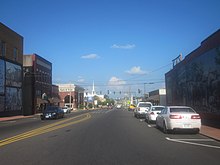
US 82B continued due east through a commercial area, including a strip mall and various restaurants.
The route turned southeast after Fairview Street, a direction it followed until meeting US 79/US 82 where it terminated near the city limits.
[15][16] By the end of 1926, the portion of SR 50 in the eastern part of Albany had a "completed hard surface".
[16][17] By the middle of 1930, from west of Albany to the Worth–Tift county line, the highway had a completed hard surface.
The western half of the Dougherty County portion of the Dawson–Albany segment had a completed semi hard surface.
was a business route of SR 50 that existed in the city limits of Albany within Dougherty County.
[15][16] By the end of 1926, the portion of SR 50 in the eastern part of Albany had a "completed hard surface".
[16][17] By the middle of 1930, from west of Albany to the Worth–Tift county line, the highway had a completed hard surface.
The western half of the Dougherty County portion of the Dawson–Albany segment had a completed semi hard surface.
Its former path from Dawson to Jekyll Island was redesignated as part of SR 520.