Springside, North Ayrshire
Springside (NS370386) lies on the old main road from Irvine to Kilmarnock, with a junction for Cunninghamhead and Stewarton district.
The name infers church ownership, possibly through a feudal grant of land by a local baron in pre-reformation times.
[5] The Bankhead area of Springside is named after them, indeed Bankhead was the main name for the area until the Royal Mail reorganised its postal districts in the 1930s and at that point many hamlets and other localities ceased to exist officially, such as Springhill, Corsehill, and Kirklands.
The earliest recording of the Bankhead surname is from 1527 in Riccarton parish, and there are many references to the family in Kilmaurs / Kilwinning / Irvine in the 16th and 17th centuries.
Bankhead is, of course, an exceedingly common Scottish placename in its purely descriptive context; however, it is a most uncommon surname.
It was home to various families, such as the Montgomerys, Rosses, Mures, Cuninghames, Peebles, Wreys and Sturrocks, before becoming a school, opened by Barnardo's in September 1971 for children with emotional difficulties aged 11 to 16 years.
Warrix (now Warrick) Hill also formed part of the demesne of the De Morvilles who forfeited their lands to Robert the Bruce.
This son had only a daughter as heir and she married Sir William Douglas and thus the property passed by marriage to the Barclay's of Pierstoun.
Warrixhill became divided into two and the Montgomeries of Bourtreehill held one half whilst the Cunninghamhead family obtained the other.
The present Craig House, further up the hill, dates from c1780 and was enlarged c1835 and a portico and perron added by Kilmarnock architect James Ingram.
[11] After the school closed in the 1980s the house was vandalised and eventually burnt out with the loss of all the interiors and the portico which had collapsed.
The 1860, 1898–1904 and, 1911 and 1912 OS maps all show that the extent to which Springside was surrounded by collieries, coal pits and freight only railway or 'tram' lines.
These were all served by standard gauge mineral railway lines, criss-crossing the countryside; they all now lifted, with only a few embankments left to indicate their original course.
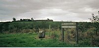
The waste bing of Springhill (Pit No.3) still lies close to Springside in the field that may have been the Thorntoun deer park.
The Corsehill tileworks made tiles for drainage and the excavation of clay lead to the creation of several large ponds.
[5][13] The station never had any freight facilities and trains ran from Kilmarnock to Ardrossan where they connected with Clyde coast steamer services to Arran and Millport.
In addition to providing better surfaces and more direct routes, the turnpikes settled the confusion of the different lengths given to miles,[15] which varied from 4,854 to nearly 7,000 feet.
The County Council in 1932 planned to demolish most of the old miners' rows, and this was largely carried out, with new housing erected.
[18] Strawhorn[11] states in 1951 that a fair number of inhabitants are of Cornish extraction, having been brought up here to break a coal workers strike in the 1880s.
Ayr County Council took it over and had the building refurbished and turned it into the Springside Community Centre of today.
On the 1895 OS map, a smithy is marked in the position where the community centre is now located, giving some doubt as to the date of the institute construction as being in the 1840s.
The revised 1905 map shows the institute and a smithy to the right of it where a small housing development of that name has recently been built (2006–07).