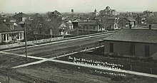
Sterling, Colorado
[5] Sterling is the largest city in the Eastern Plains region of Colorado and the site of the domed Logan County Courthouse, built in 1909.
[8] The community was named for Sterling, Illinois, the native home of a railroad official.
[9] Sterling is 128 miles (206 km) northeast of Denver, and is located on Interstate 76, on the 'eastern plains' of northeastern Colorado.
According to the United States Census Bureau, the city has a total area of 7.43 square miles (19.2 km2), all land.
[citation needed] Sterling is the major shopping hub for most of northeastern Colorado and hosts big box retailers, as well as many local stores located primarily on Main Street.
Crosson Field serves as Sterling's airport, but there are no scheduled commercial flights available from there.
The closest Amtrak station is located in Fort Morgan, Colorado, about 47 miles (76 km) away.