Stirling (council area)
The district covered parts of the historic counties of Stirlingshire and Perthshire, which were abolished for local government purposes.
The majority of the population of the area is located in its southeast corner, in the city of Stirling and in the surrounding lowland communities: Bridge of Allan and Dunblane to the north, Bannockburn to the immediate south, and the three former coal mining communities of Cowie, Fallin, and Plean, known collectively as the "Eastern Villages".
The southern half of this rural area comprises the flat western floodplain of the River Forth, bounded on the south by the Touch Hills and the Campsie Fells.
Following Chris Kane being elected as MP for Stirling and Strathallan, Labour Councillor Margaret Brisley became leader of the Council, but died on 27 October 2024,[15] and a by-election was held to fill the vacancy caused by her death.
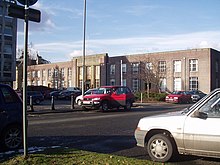
[19] A new building called New Viewforth was built alongside the older premises in 1972, shortly before Stirlingshire County Council was abolished.
[23] Since 2007 elections have been held every five years under the single transferable vote system, introduced by the Local Governance (Scotland) Act 2004.
[27] As well as the city of Stirling itself, there are many towns, villages and hamlets spread across the council area, as well as dispersed settlements.