Stratus cloud
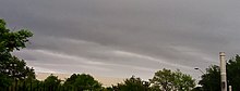
The term stratus describes flat, hazy, featureless clouds at low altitudes varying in color from dark gray to nearly white.
[3] Stratus clouds may produce a light drizzle or a small amount of snow.
Stratus clouds form when weak vertical currents lift a layer of air off the ground and it depressurizes, following the lapse rate.
[6] They are found at low altitudes, and are a good sign of atmospheric stability, which indicates continuous stable weather.
The Stratus opacus variety appears as a nebulous or milky sheet of the nebulosus species, but are opaque enough to block the sun from view.
Though rare, this cloud formation is caused by disturbances on the gentle wind shear.
Stratus stratocumulomutatus clouds occur when stratocumulus opacus patches fuse to create a stratiform layer.
It is common for a stratus to form on a weak warm front, rather than the usual nimbostratus.
According to Sednev, Menon, and McFarquhar, Arctic stratus and other low-level clouds form roughly 50% of the annual cloud cover in Arctic regions, causing a large effect on the energy emissions and absorptions through radiation.
Towards the bottom, at temperatures of around −35 °C (−31 °F) to −45 °C (−49 °F), the crystals tend to be long, solid, hexagonal columns.
Additionally, stratocumulus clouds reflect a large amount of the incoming sunlight, producing a net cooling effect.