Sutherland Shire
Sutherland Shire is a local government area (LGA) in the southern region of Sydney, in the state of New South Wales, Australia.
[3] Sutherland Shire contains what was the first landing site of Lieutenant James Cook, who went ashore onto what is now the suburb of Kurnell on 29 April 1770.
Of all the people in Sydney – Sutherland (Statistical Area Level 4) aged 15 years and over, 53.7% were married and 10.4% were either separated or divorced.
The most common ancestries in Sydney – Sutherland (Statistical Area Level 4) were English 27.6%, Australian 26.3%, Irish 9.5%, Scottish 6.9% and Italian 3.2%.
The original coastline around Sydney has retreated about 20 km and that those flooded coastal plains may hold evidence showing occupation of this area going back well beyond the 8,500 years revealed in the 1966 Archaeological exploration.
[22] Seashells became an important source of lime in the 1800s, and so, many middens in the Shire may have been mined for shells in order to produce mortar for construction.
Since 1966, when there was an archaeological dig in Cabbage Tree Basin, archaeologists have uncovered parts of an extensive open-air midden or cooking and camp sites.
Successive layers of habitation show the diet of the native Aboriginal people: oysters, mussels, snapper, bream, and Sydney cockle.
[24] European discovery of what is now Sutherland Shire was made by Lieutenant James Cook, who entered Botany Bay on 29 April 1770.
Botany Bay was chosen as the new penal settlement and the First Fleet under Governor Arthur Phillip anchored off Kurnell on 18 January 1788.
The first landowner in Sutherland Shire was James Birnie, a mercantile trader who was granted by promise 700 acres (280 ha) at Kurnell in 1815.
[26] After the completion of official surveying, a large part of what is now Sutherland Shire was proclaimed as the Hundred of Woronora by Governor Richard Bourke in 1835.
Farmers' ships sailed up the coast into Botany Bay, and up the Georges and Woronora rivers, avoiding the wharfage and custom dues at Port Jackson.
[30] Coastal and river frontage areas, such as Como, Illawong, Cronulla, Illawarra and Yowie Bay, became popular as country retreats.
[citation needed] After the Second World War, the Housing Commission, under the auspices of William McKell, began acquiring land to build "homes for heroes", including in the Shire.
[30] In January 1994, the 1994 Eastern seaboard fires destroyed parts of Como West, Jannali and Bonnet Bay; and affected the southern suburbs of Bundeena, Maianbar and Heathcote.
[32] In the 2011 census, Sutherland Shire was the second[dubious – discuss] most populous local government area in New South Wales, and eighth in Australia overall.
On 11 December 2005 and the days that followed, a series of riots and retaliatory attacks broke out in Cronulla and other beach-side suburbs in Sydney's east which saw numerous assaults.
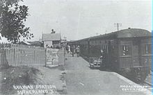
With the establishment of the Sutherland Shire on 6 March 1906, the western boundary was extended to take in more agricultural land in an area which is now modern day Menai.
In the eastern part the Sutherland Shire has a varying landscape of rugged sea cliffs and sandy beaches, and swampy bay coasts backed by sand dunes.
[47] The geology of Sutherland Shire, whilst sharing characteristics with the North Shore, is very different from the western and central suburbs of Sydney.
In the final stages of this period of erosion the climate was apparently rather wetter and more humid than today's, causing the exposed rocks to change and form laterite soil, which is abundant in the Sutherland Shire.
The slow uplift, taking perhaps several million years, formed the present Woronora Plateau, a surface which rises gently in the south.
During the last ice age, the rivers had to do additional work cutting down through the rocks to reach the lower and more distant ocean, leading to the "valley-in-valley" shape of many of the deep gorges in the Sutherland Shire.
The reactor, run by the Australian Nuclear Science and Technology Organisation (ANSTO) is not a power station but is used for the production of radiopharmaceuticals, for research and irradiation.
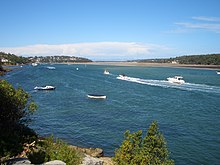
The isolated suburbs of Bundeena and Maianbar are situated on the southern shore of Port Hacking between the water and the Royal National Park.
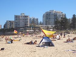
The clubs and boats provide life saving and first aid services to the many visitors to the Sutherland Shire's beaches and rivers.
Anthony Redmond claims the Shire has a reputation for insular localism that also manifests itself in surf culture, has a high conservative vote and is Sydney's fourth largest Bible belt.
Cronulla is also a popular retail and commercial centre, with numerous restaurants and cafes and a considerable number of surf stores and other clothing and fashion shops.
Since 1956, Sutherland Shire has been home to ANSTO’s Lucas Heights research campus, and the HIFAR, MOATA and OPAL nuclear reactors.