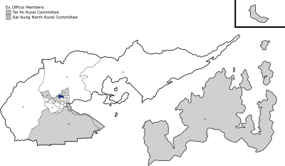
Tai Po Market
The first Tai Po Hui (Chinese: 大埔墟; Jyutping: daai6 bou3 heoi1; Cantonese Yale: daaih bou hēui; lit.
In Kangxi Year edition of Xin'an Xianzhi (Gazetteer of the Xin'an County (or San-On County in the Cantonese language)), the market town was also known as Tai Po Tau Hui (大步頭墟; daai6 bou6 tau4 heoi1; daaih bouh tàuh hēui; 'Tai Po Tau Market').
[2] The market town was located in the northern shore of the Lam Tsuen river mouth.
[3] It was said Tai Po Hui was one of the three major market towns of Hong Kong [sic][nb 1] in the early Qing dynasty.
The District Office of the colonial Hong Kong government, also within the proximity of both new and old Tai Po Hui.
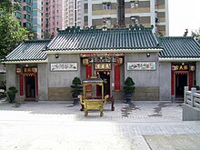
[7] The temple, at the heart of the Fu Shin Street, is a declared monument of Hong Kong.
As the main circular road was intended to facilitate the movement of troops, it avoided the centres of population.
[7] A Tin Hau Temple existed in the modern day Tai Po Old Market.