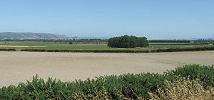
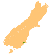
Taieri Plain
The alluvial nature of the land means that floods are not uncommon, especially in the area around the confluence of the two rivers.
[2][3] New Zealand's lowest point, at 2m below sea level, is slightly north of the airport on Kirk's Drain Road, Momona.
To the northeast, the city of Dunedin is separated from the Taieri Plain by a range of rugged hills which are part of the crater of an extinct volcano.
At the northeastern limit of the plain lies the town of Mosgiel, officially part of the city of Dunedin.
[1] The twin lakes of Waihola and Waipori sit within these hills, as does the Sinclair Wetlands Reserve.