Tanjungpura Kingdom
The kingdom experienced several moves of the royal capital, first located in Negeri Baru (current village name) Ketapang Regency, then moved to Sukadana (currently the capital of North Kayong Regency), since Panembahan Sorgi (Giri Kesuma) embraced Islam.
The name "bakula" comes from Sanskrit which means a tanjung plant (Mimusops elengi), so that after being elongated it became Tanjungpura.
The island of ancient Borneo was divided into three major kingdoms: Brunei, Sukadana (Tanjungpura) and Banjarmasin.
However, recent studies suggest that Poli (or Poni) refers to a Santubong kingdom at the mouth of the Sarawak River, which was once called Punik estuary.
[7] Inland borders, the headwaters of the Pinoh (Lawai) river basin were included in the territory of the Kotawaringin Sultanate (subordinate to Banjarmasin).
[8] During the time of Mahapatih Gajah Mada and Hayam Wuruk as mentioned in Kakawin Nagarakretagama, the Negeri Tanjungpura became the capital of the areas claimed as Majapahit conquests in Tanjungnagara Nusa (Kalimantan).
Other opinions assume that Tanjungpura was in South Kalimantan as a more strategic base to control a wider area.
Some of the reasons why Tanjungpura Kingdom moved its capital were mainly due to attacks from pirate gangs, known as Lanon (lanun).
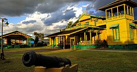
During the reign of Sultan Muhammad Zainuddin (1665-1724), the centre of the palace shifted again, this time placed in the Sungai Matan area.
And during the reign of Sultan Muhammad Zainuddin, around 1637,[14] moved again to Indra Laya so it was called the Indralaya Kingdom.
Then it was called Kartapura Kingdom because it moved again to Karta Pura in Tanah Merah village, Nanga Tayap sub-district, then to Tanjungpura Village now (Muara Pawan sub-district) and finally moved again to Muliakarta in the Muhammad Saunan Palace which is now the last as the centre of self-government.
[15] The crown prince was then married a Dayak princess, Dayang Putung,[16] and build a kingdom in Kuala Kandang Kerbau.
His successor was Sibiring Mambal, titled Pangeran Dibarok, because the crown prince, Giri Kesuma, was at that time still under age.
[citation needed] Pangeran Giri Kesuma then gave a title to the son of syeh Husein, Syarif Hasan, as Sultan Aliuddin.
A map created by Oliver van Noord in 1600, depicted the locations of Succadano, Tamanpure, Cota Matan, and Loue.
Gusti Mesir became a prisoner of the Imperial Japanese army who captured Indonesia from the Dutch in 1942, so there was a government vacuum in the Kingdom of Simpang.