Tonkin Highway
[9]: 73–74 In 2013, immediately preceding the upgrade of Tonkin Highway's central section to a six-lane freeway-standard road, junctions in and around Kewdale, Forrestfield and Perth Airport carried traffic volumes beyond their capacity during peak periods.
The slowest section was from Leach Highway to Horrie Miller Drive, which recorded an average of 14 km/h (9 mph) during the afternoon peak period.
Following the completion of the Gateway WA project in 2015, the upgraded road network is forecast to have an average speed in peak periods of between 55 and 75 km/h (35 and 45 mph) in 2021.
The highway then enters the Perth metropolitan region (the City of Swan LGA, or local government area) and provides a western bypass of the town of Bullsbrook.
The highway then curves back to the south and passes between the suburbs of Cullacabardee and Whiteman, replacing a section of Beechboro Road North.
The highway heads south to cross over Baal Street, after which another roundabout interchange is reached with Hepburn Avenue and the remainder of Beechboro Road North.
From here the highway turns south-easterly, perpendicular to the Swan River, and travels through another residential part of Bayswater for 1.2 kilometres (0.75 mi).
Previously, Great Eastern Highway's intersection with the southbound exit ramp also connected to Brearley Avenue which, until September 2018, provided one of the main access roads to Perth Airport's domestic terminal.
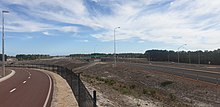
Known as the Grand Gateway interchange, it is the primary access to Perth Airport's international terminal (replacing Horrie Miller Drive in 2015).
Now a single-point urban interchange, the initial signalised intersection was the original primary access road for Perth Airport's international terminals.
[18] Beyond this intersection, the highway enters the City of Kalamunda LGA, and is the location of the border between the suburbs of Kewdale to the south-east and Forrestfield to the north-east.
[19] Tonkin Highway travels in a south-easterly direction between residential areas in Forrestfield and Wattle Grove, reaching Hale Road after 1.2 kilometres (0.75 mi).
Beyond this intersection, Tonkin Highway continues south-east as the border between the semi-rural areas of Kenwick to the west, and Wattle Grove to the east.
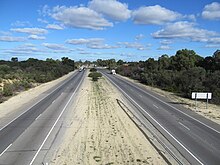
Tonkin Highway follows a gentle reverse curve southwards through Martin for 2.1 kilometres (1.3 mi), once more within a semi-rural environment, before reaching a set of traffic lights with Mills Road East and West.
Tonkin Highway turns south, along a two-kilometre-long (1.2 mi) curve, and meets Armadale Road at another set of traffic lights.
[22]: 282–3 This $6.1 million section, which officially opened on 22 December 1980,[23] was the start of a new route between Gosnells and Bellevue,[note 2] and reduced traffic volume and congestion on Albany Highway.
[22]: 283 The third segment to be constructed was a 3.6-kilometre-long (2.2 mi) section north of the Swan River, from Railway Parade in Bayswater to Morley Drive, which opened on 11 July 1984.
Planning and Infrastructure Minister Alannah MacTiernan and the Member for Roleystone, Martin Whitely, participated in a sod turning ceremony on 27 June 2003, to mark the start of the project.
[26] The first 11-kilometre-long (6.8 mi) section, including a new interchange at Albany Highway, was opened by Premier Geoff Gallop and Alannah MacTiernan on 2 April 2005.
[29] The Forrestdale Business Park and the Champion Lakes precinct were constructed concurrently with the project, to encourage industrial and residential development alongside the new highway section.
At the time it was the largest project Main Roads Western Australia had ever undertaken, covering the upgrade of Tonkin and Leach highways, and the construction of four new interchanges.
[18][32] In January 2013, works were undertaken to protect or relocate sections of the Canning Trunk water main and the Dampier to Bunbury Natural Gas Pipeline in the vicinity of the project.
[33] Construction on the Gateway WA project officially began on 1 February 2013 with a groundbreaking ceremony attended by the state and federal transport ministers, Troy Buswell and Anthony Albanese.
During 2016, the intersection with Gosnells Road West was upgraded with longer and extra turning lanes, better cycling and pedestrian facilities, and better street lighting and CCTV as part of the Black Spot program.
[39] Dunreath Drive, a local road that originally ran parallel with Tonkin Highway to the east, provided an alternative route between the Perth Airport terminal buildings.
[47] However, the intersection did not allow northbound travellers to bypass the Great Eastern Highway interchange in order to access the domestic terminal.
[48] In its place was a dogbone interchange linking Tonkin Highway to Dunreath Drive, allowing full movements to and from the T3/T4 precinct.
[52] A number of improvement works are planned for Tonkin Highway, which will see the entire route eventually upgraded to a freeway-standard road with grade separated interchanges.
[56][57]: 1 Following the 2001 state election, the new government abandoned the Jarrahdale Road option, preferring a shorter route that deviated to South Western Highway near Orton Street, closer to Byford.
The group met several times to identify and evaluate possible solutions to traffic congestion in the area, and prepare a strategic business case for the next extension.