Transportation in Virginia
Virginia's extensive network of highways and railroads were developed and built over a period almost 400 years, beginning almost immediately after the founding of Jamestown in 1607, and often incorporating old established trails of the Native Americans.
During the colonial period, the Virginia Colony was dependent upon the waterways as avenues of commerce, and James River Plantations such as John Rolfe's Varina Farms with their own wharfs on the rivers of the Fall Line (at present-day Richmond were soon shipping tobacco and other export crops abroad.
By the 19th century, the Virginia Board of Public Works was funding transportation infrastructure improvements, stimulating such private enterprises as the James River and Kanawha Canal, the Chesterfield Railroad, and the Valley Turnpike.
Prior to the creation of the Interstate Highway System, Virginia had some other notable roads to handle heavy traffic including Military Highway in South Hampton Roads, Mercury Boulevard on the Virginia Peninsula, and State Route 168, which extended from west of Williamsburg to the North Carolina border near the eastern edge of the Great Dismal Swamp, including Tidewater Drive in the Norfolk area.
The Atlantic Ocean is accessed by the more sheltered Chesapeake Bay and Hampton Roads, with 5 major navigable rivers offering a wide choice of ports and industrial sites.
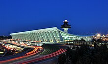
In modern times, major commercial airports are located around the state, with many additional general aviation facilities.
Virginia's scenic byways include the Skyline Drive in Shenandoah National Park and the Blue Ridge Parkway.
Even in busy Northern Virginia, a bucolic interlude is available inside the beltway on the George Washington Memorial Parkway.
The state has literally dozens of other stretches of roads designated as scenic byways, and VDOT distributes a free map showing them.
[1] Interstate 66, another heavily traveled route into Washington, DC, connects the Capital Beltway to I-81 at Front Royal, Virginia.
(The study also identified such issues as drainage, speed limits, and planning and coordination of roads with development as those local leaders felt should be within their control).
[4] The streets and roads in two counties, Arlington and Henrico, as well as some of the incorporated towns, and all of the independent cities are maintained by the various localities.
In the early 21st century, the Virginia General Assembly was considering legislation to allow some additional counties (most likely those in fast-growing areas) to choose to resume control and care for the secondary highways within their boundaries.
These include: The Capital Beltway circles Washington D.C. through Northern Virginia, Maryland, and a tiny edge of the District of Columbia.
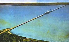
The Hampton Roads Beltway extends 56 miles (90 km) on a long loop through the region, crossing the harbor on two toll-free bridge-tunnel facilities.
A study undertaken in 2010 examined the possibility of a rapid transit line along Broad Street in Richmond, for which light rail was considered.
Instead, a Bus Rapid Transit option was chosen for its lower capital costs, and the GRTC Pulse BRT line opened in 2018.
[7] North Carolina also does this, as well as supporting Amtrak lines directly and owning a railroad,[8] and is in a rail compact with Virginia.
[10] Lorton, Virginia, is the northern terminus for Amtrak's non-stop Auto Train, which allows passengers to take a motor vehicle on an overnight trip between there and Sanford, Florida, just outside of Orlando.
The port is located only 18 miles (29 km) from open ocean on one of the world's deepest, natural ice-free harbors.
Since 1989, Hampton Roads has been the mid-Atlantic leader in U.S. waterborne foreign commerce and is ranked second nationally behind the Port of South Louisiana based on export tonnage.
The Hampton Roads region's economic base is largely port-related, including shipbuilding, ship repair, naval installations, cargo transfer and storage, and manufacturing related to the processing of imports and exports.
The harbor of Hampton Roads is an important highway of commerce, especially for the cities of Norfolk, Portsmouth, and Newport News.
In addition to the lower portion of the Chesapeake Bay and the harbor of Hampton Roads, navigable rivers include: The Atlantic Intracoastal Waterway passes through eastern Virginia.