Trimontium (Newstead)
The location benefitted from the rivers Tweed and Leader providing routes for the movement of goods and people and from the Roman road that became Dere Street passing alongside the fort.
Around 105 there appears to have been a serious setback at the hands of the tribes of the Picts: several Roman forts were destroyed by fire, with human remains and damaged armour at Trimontium indicating hostilities.
From its first construction phase in c.80 AD through to the last occupation and retreat shortly after 180[8] the fort would have been a focal point and centre of activity for both Romans and locals alike.
The local Iron Age population, living in family farmsteads across the region, and gathering at times within the network of hillforts across the landscape would have had to develop a range of strategies to exist within or alongside the Roman presence.
[citation needed] This was managed by combining evidence from the first excavations of James Curle[9] and Sir Ian Richmond[citation needed] with aerial photographs and modern search and rescue excavations of Bradford University (1987–1997)[10] Phase 1 (c.79-87 AD): The earliest occupation of the site identified by aerial photographs since the 1940s have revealed at least three and possibly as many as five camps in this area.
[11][12] The enormous "Great Camp" identified by Curle was on the highest point of the ridge at the centre of the whole enclosure, commanding a view over the road from the Cheviots, and across the Leader valley to control the crossing of the river.
The later smaller Agricolan fort was built to the west of the Great Camp about 80 AD by the Legio XX Valeria Victrix mentioned on many of the inscriptions.
[15] Phase 7 (c.160-184 AD): As the civilian population surrounding and supporting the fort diminished further, the land that housed the annexes returned to a more natural state.
[5] The earliest modern reference to the archaeological significance of Trimontium stems from finds uncovered during mid-Victorian railway cutting works as part of the Waverley Line construction in 1846.
At this time, with the advent and development of aerial photography as a tool in modern archaeological research, Dr Kenneth St Joseph’s work at Trimontium revealed up to nine temporary encampments, evidenced through cropmarkings.
Initially under the direction of Dr. Rick Jones, and thereafter Dr. Simon Clarke, the project employed the most modern archaeological techniques to the Trimontium site for the first time.
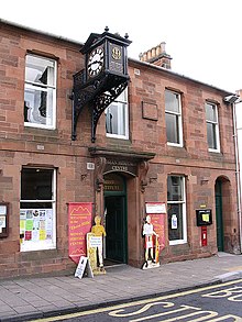
The museum's £1.4 million redevelopment was part of a project supported by the National Lottery Heritage Fund to enhance and extend the galleries, displays and interpretation of Trimontium's history.
The trust carry out guided walks to the Trimontium site, run a lecture and talk series, undertake activities linked to local community events, and present school and family workshops.
The Trimontium Trust museum redevelopment project has seen key finds return to the vicinity of the original fort site & archaeological excavations.
They are housed within this contemporary museum setting which extends, redesigns, reinterprets and re-displays objects telling the story of Trimontium and its relationship with the local population.