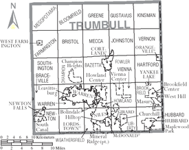
Trumbull County, Ohio
After losing the Seven Years' War to Great Britain, France was forced to cede its territories east of the Mississippi River in 1763.
Following the United States' victory in its Revolutionary War, the British were forced to cede this land to the new nation.
The county's main city, Warren, was originally founded as the capitol of the Western Reserve territory.
Early settlers did believe they noted an ancient village site in Kinsman, a more contemporary site in Hartford, and several strange stone constructions were noted in the Black Ash Swamp by early Bristol residents- this area now known as the Grand River Preserve.
Many presumably different groups of Natives were still frequenting camps in the vicinity of Newton Falls and somewhere near the Champion-Warren township border when modern Americans first began to settle there.
A memorial stone piles believed to have been Native in origin was situated on the West Bank of the Mahoning, but was later removed for construction purposes.
[5] Before 1600, the area was ambiguously between the territories of the Erie people to the east and the Whittlesey Culture to the west.
After the Beaver Wars, the area was frequented by travelling Lenape, Wyandot, Ottawa, Shawnee and Seneca, who all had settlements nearby for a time and shared the valley's animal, food and medicinal resources.
The Natives collectively used this area as a shared hunting ground, but had to give up ownership of the region for settlement as punishment for participating in the Northwest Indian War.
Some of the final Native residents were camped along the Grand River in Mespotamia during the war, leading to an upsetting altercation in which the locals found and ransacked their camp and, as a warning to leave, carved an image of a Native man into a tree and shot it.
The Natives responded by carving a white man into a tree without a mark on it, but seem to have later felt it was unsafe to stay and left.
They could have gone south to Prophetstown, a religious compound run by Tecumseh's brother, and got caught up in the Shawnee War and War of 1812, or they and several other Native communities scattered around northeast Ohio may have condensed into a handful of settlements in the Cuyahoga River, before the majority of them relocated west in 1813 to either live with the main Ottawa or Wyandot tribe.
[8] Early settlements were made along the Mahoning River and other waterways, which provided transportation access and water power to the industries that developed later in the 19th century.