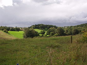
Tunnel valley
[4] Tunnel valleys are typically eroded into bedrock and filled with glacial debris of varying sizes.
[1] A part of a tunnel valley may go uphill: water can flow uphill if it is under pressure in an enclosed pipe: for example in Doggerland (submerged land which is now part of the bed of the North Sea) are some infilled tunnel valleys that flowed from north to south across the hollow of the Outer Silver Pit.
[5] They vary in channel depth and width; Danish examples run from 0.5–4 km (0.31–2.49 mi) wide and from 50–350 m (160–1,150 ft) deep.
They typically exhibit the largest cross-sectional area in the center of the course and terminate over a relatively short distance in elevated outwash fans at the ice-margin.
[1] Tunnel valleys are found to cross the regional gradient – as a result they may be crosscut by modern stream networks.
In one example, tributaries of the Kalamazoo River cut at nearly right angles across buried tunnel channel filled with ice and debris.
They originate in and run through regions which include clear evidence of glacial erosion through abrasion and may exhibit striations and roche moutonnée.
They erode by meltwater, which it has been argued, episodically drains in repeated jökulhlaups from subglacial lakes and reservoirs; examples of such motion have been observed in Antarctica.
Although there is evidence of ice erosion such as linear striations in the bedrock, these are observed only in the widest valleys, and are believed to have played a secondary role.
They can exhibit reverse gradients, which result when pressurized meltwater flows over obstacles such as ridges or hills along the glacier bed.
[9] Tunnel valleys can be formed under extremely thick glacial ice – examples have been observed on the bottom of Lake Superior and in the oceans offshore in Antarctica.
The analytic model shows that over some regions, the ice-bedrock geometry included sections which would have frozen, blocking off flow, unless erosion of the sedimentary substrate was the means of creating a channel and sustaining the discharge.
With progressive sediment erosion by the meltwater, ice deforms under its own weight into the cavity to creating an ever-larger tunnel valley.
As the flow continues, it tends to erode the underlying materials and the overlying ice, creating a channel even as the reduced pressure allows most of the glacial ice to settle back to the underlying surface, sealing off the broad front release and channelizing the flow.
[4][9] Analyses by Piotrowski demonstrate that the annual production of water from one typical catchment of 642,000,000 m3 (2.27×10¹⁰ cu ft) would normally drain through its associated tunnel valley in less than 48 hours.
This erosive environment is consistent with creation of tunnels over 400 m (1,300 ft) deep and 2.5 km (1.6 mi) wide, as have been observed in the Antarctic.
[9] Piotrowski's model predicts a cycle as follows: Tunnel valleys have similar characteristics, irrespective of whether they are formed on land or in a submerged environment.
[17] The tunnel valley sedimentary record is controlled by meltwater release flow rates and sediment burdens during glacial recession.
Punkari identified that continental ice sheets typically flow in fan-shaped lobes, which converge from separate sources and move at differing speeds.
The hydraulic head (pressure) is lower in areas of thinner ice; hence subglacial water tends to converge on the interlobate joint.
Specifically, tunnel valleys and eskers indicate water flow toward the interlobate zones, which are elevated as the result of debris carried and deposited there.
Tunnel valleys associated with the Late Ordovician glaciation have been observed in north African countries, including Libya.
[20] These large-scale channel-fill sandstone bodies (tunnel valleys) are a striking sedimentological feature of the glacially related deposits on the old North Gondwanaland margin.
In one example, in Mauritania, in the western Sahara, Late Ordovician siliciclastic glacial features and deposits on the North Gondwana continental shelf include incised channels identified as tunnel valleys.
[3] Open-pit gold mines near Kalgoorlie, Western Australia, expose an extensive network of glacially-eroded valleys filled with tillite and shale cut below the Late Paleozoic Pilbara ice sheet.
[23] Tunnel valleys and related glacial impacts have been identified in Russia, Belarus, Ukraine, Poland, Germany, Northern France, the Netherlands, Belgium, Great Britain, Finland, Sweden, Denmark and Norway.
[24] They have been studied in detail in Denmark, north Germany and north Poland where the thick ice sheet of the Weichsel and earlier Glaciations, having flowed down from the mountains of Scandinavia, began to rise up the north-European slope, driven by the altitude of the glacial ice accumulation over Scandinavia.
It is a very straight, narrow gorge about 50 to 100 ft (15 to 30 m) deep that contains part of the lower segment of Cedar Creek, the largest tributary of the St. Joseph River.
Seismic reflection profiles of the fill of tunnel valleys suggest that they are of various ages, with the youngest dating from shortly after the Late Glacial Maximum.
Lake Argentino periodically breaks through in outburst floods with drainage initially through a tunnel with subsequent roof collapse to form an open channel.