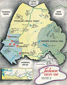
Tuolumne County, California
[8] Tuolumne County comprises the Sonora, CA Micropolitan Statistical Area.
The northern half of Yosemite National Park is located in the eastern part of the county.
The name Tuolumne is of Native American origin and has been given different meanings, such as Many Stone Houses, The Land of Mountain Lions, and Straight Up Steep, the latter an interpretation of William Fuller, a native Chief.
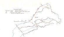
With the State's Adoption of the Political Code in 1872 the current boundaries of Tuolumne County were largely established as shown in the maps below.
There is no public transportation into or out of Tuolumne County that connects to any of the closest metropolitan areas.
The following table includes the number of incidents reported and the rate per 1,000 persons for each type of offense.
The 2010 United States census reported that Tuolumne County had a population of 55,365.
The government provides services such as elections and voter registration, law enforcement, jails, vital records, property records, tax collection, public health, and social services.
Tuolumne county tends to vote Republican in Presidential and congressional elections.
[34] Tuolumne County is in California's 5th congressional district, represented by Republican Tom McClintock.
The population ranking of the following table is based on the 2010 census of Tuolumne County.