U.S. Route 101 in Washington
US 101 is the westernmost route of the United States Numbered Highway System, traveling along the Pacific Coast from Los Angeles, California, to Oregon and Washington.
US 101 turns west around the head of Baker Bay near Port of Ilwaco Airport and intersects its short alternate route, which bypasses the coastal section of the highway.
[3][13] US 101 then dives southwesterly along the Wallacut River into Ilwaco, where it runs through town as Spruce Street and turns north onto 1st Avenue at an intersection with SR 100, which provides access to Cape Disappointment State Park.
[3] After intersecting the northern terminus of its alternate route, the highway turns north to cross the Wallacut River again and pass through hills on the south end of Willapa Bay.
[14] SR 105 forms a full loop around US 101 between Raymond and Aberdeen along the Pacific Coast and Grays Harbor, serving the city of Westport in the process.
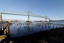
[17] US 101 continues through Aberdeen and its residential neighborhoods, turning northwest onto Alder and Park streets and west onto Sumner and Simpson avenues before it enters Hoquiam.
[3][19] US 101 continues north on Lincoln Street and turns west onto Perry Avenue before crossing the Little Hoquiam River and intersecting the eastern end of SR 109 Spur.
[14][21] The highway leaves the Quinault Indian Reservation and enters Olympic National Park, where it serves several beaches around Kalaloch and designated campsites facing the Pacific Ocean.
[23] After leaving Forks, the highway intersects SR 110, a scenic route along the Sol Duc River that provides access to La Push and the Quileute Indian Reservation.
[3][14] US 101 continues northeast through the Sol Duc Valley, turning east after passing Lake Pleasant at Beaver and intersecting SR 113, which travels north towards Clallam Bay.
[25] US 101 then intersects SR 112, which continues west towards the Makah Indian Reservation at the northwest corner of the contiguous United States,[26] and turns east to enter Port Angeles.
[3][14] The highway travels east through the industrial outskirts of Port Angeles, where it passes William R. Fairchild International Airport and an interchange with SR 117, a truck route with direct access to the city's waterfront.
Lauridsen continues east to the Olympic National Park headquarters, the north end of the road to Hurricane Ridge, and the Peninsula College campus.
[3] US 101 then follows Snow Creek south to an interchange with SR 104, which crosses the Hood Canal Bridge to the Kitsap Peninsula, and passes a series of lakes in the eastern foothills of the Olympic Mountains.
US 101 traverses a small pass at 750 feet (230 m) above sea level and begins a southeastern descent along Spencer Creek to reach Dabob Bay on Hood Canal.
[29] The highway leaves the national forest and follows the bay and canal south through Brinnon and a trio of state parks: Dosewallips, Pleasant Harbor, and Triton Cove.
[31] The highway follows Oyster Bay and Scheider Creek southeast to the Eld Inlet in Thurston County, where it turns south and approaches a partial interchange with SR 8, which continues west toward Aberdeen.
[37] The Washington State Highway Commission submitted an application to AASHO in 1955 to extend US 101 northeast from Discovery Bay to Whidbey Island and Mount Vernon, where it would terminate at US 99.
[41] A freeway bypass of Shelton with several interchange was proposed by the state government in the 1960s; its construction would require the relocation of radio station KMAS and 10 residences.
[1][46] The alternate route was constructed in 1931 as the Skinville Cutoff and added to the state highway system in 1937 as a branch of PSH 12,[47] which was co-signed with the southwestern portion of US 101.