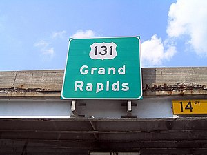
U.S. Route 131
As the road crosses into Michigan it becomes a state trunkline highway that connects to the metropolitan areas of Kalamazoo and Grand Rapids before continuing north to its terminus at Petoskey.
US 131 forms an important corridor along the western side of the Lower Peninsula of Michigan, running through rural farm and forest lands as well as urban cityscapes.
An attempt to dedicate the highway to poet James Whitcomb Riley failed to gain official support in Michigan.
[10] North of the other end of the business loop, US 131 follows a four-lane surface highway through rural farmland in northern St. Joseph County.
[14] North of this area US 131 crosses the Kalamazoo River and runs past the US 131 Raceway Park, a dragstrip close to the M-222 interchange near Martin.
[1] As it continues along the river the freeway passes through the unincorporated community of Comstock Park and near to LMCU Ballpark, home of the West Michigan Whitecaps local minor league baseball team.
M-46 joins US 131 from the west at Cedar Springs and the two highways pass into northwestern Montcalm County near Sand Lake.
[11][12][13] The two-lane highway runs through the Pere Marquette State Forest and over the Manistee River,[12] crossing the southeast corner of Grand Traverse County.
[13] The highway passes through rural Charlevoix County where the terrain has many rolling hills and begins to descend to Lake Michigan.
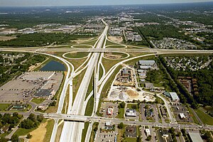
[11] A ninth rest area used to exist near Cutlerville on the northbound side of US 131,[21] but this location was demolished on January 22, 2001, to make way for the interchange with M-6.
[26] In the 19th century, the Michigan Legislature chartered private companies to build and operate plank roads or turnpikes in the state.
[28][c] US 131 debuted along with the rest of the initial U.S. Highway System on November 11, 1926,[3] although at the time it was shown on maps from the Michigan–Indiana state line north to the small Northern Michigan community of Acme in Grand Traverse County.
[51] The MSHD had proposed that the section of US 131 south of Kalamazoo be built as an electronic highway under a bid through General Motors the same year;[52] the testing for such a roadway was ultimately done at Ohio State University instead.
The new loop used a freeway stub on the north and M-43 on the south to connect the main highway to the former routing of US 131 along Westnedge and Park avenues downtown.
During the winter months, the original lanes built in the 1920s were closed because the grade of the roadway accumulated additional snow and made it difficult to plow.
The section between the two M-57 junctions near Rockford and in Cedar Springs opened on September 21, 1973, at a dedication ceremony featuring then-Congressman Gerald R.
[72] The state even proposed adding the freeway north of Grand Rapids to Petoskey, with a further continuation to Mackinaw City as part of the Interstate Highway System in an effort to receive additional funding in 1968.
As noted by The Grand Rapids Press in 1981, "the speed limit on the S-Curve must be reduced as low as 25 mph [40 km/h] on some bad-weather days because of the sharpness of the turns and [the] numerous accidents [that] have occurred there.
[85] Construction began on January 15, 2000,[55] diverting the roughly 115,000 vehicles per day that used the stretch of road to detours through the downtown area.
[87] The system is designed to spray a de-icing fluid on the roadway that would be carried by car tires up to a mile (1.6 km) along the road surface.
A design mistake meant that one of the bridges in the structure was built a foot (30 cm) too low, and Grandville Avenue was lowered to compensate for the error.
Business owners look to the 3,000 cars and trucks that pass through downtown Constantine each day for customers, traffic that would be diverted around the village by the new roadway.
[105] State House Speaker Craig DeRoche was critical of the original decision, citing the economic development benefit such a road would bring to the area in defense of the proposed freeway.
[105] MDOT has begun a project to upgrade a 16.4-mile (26.4 km) segment of US 131 in St. Joseph County,[107] home of one of the most dangerous roadway sections in Southwest Michigan for auto crashes.
[108] The final environmental impact statement for the project was published in mid-2008 and the preferred alternative consists of a two-lane road bypassing the village of Constantine.
[111] Construction plans were placed on hold after an announcement in June 2009 as various proposals around the state, including the Constantine bypass, were shelved until funding issues could be resolved.
School children in 1926 from Anderson, Indiana, wanted to honor James Whitcomb Riley, the poet from the Hoosier State, with a highway that connected the country's summer and winter resort areas.
The James Whitcomb Riley Association promoted the highway by painting white bands on telephone poles with the name of the road in orange letters during that August and September.
However, the road in question was already named the Mackinaw Trail, and the association did not secure permission of the state highway commissioner, as was required by a 1919 Michigan law.
"[118] The Michigan Trail started in Toledo, Ohio, and ran to Detroit; its branches extended to New Buffalo, Grand Rapids, and Port Huron.