U.S. Route 24 in Michigan
The highway runs through three counties in southeastern Michigan, Monroe, Wayne and Oakland, as it parallels the Lake Erie shoreline and bypasses Metro Detroit on the west.
Telegraph Road connects several suburbs together and passes through the western edge of Detroit before it terminates northwest of Clarkston at an interchange with Interstate 75 (I-75).
The southern sections in the Downriver area south to Monroe parallel telegraph lines from the mid-19th century.
[3] All of US 24 north of I-275 is listed on the National Highway System,[4] a network of roads important to the country's economy, defense, and mobility.
[5] US 24 crosses the Ohio state line and follows Telegraph Road northeasterly through Monroe County.
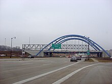
[6][7] Telegraph Road runs through downtown Flat Rock as it parallels the Lake Erie shoreline.
From here north, the road runs through residential areas of the suburb approximately three miles (4.8 km) east of Detroit Metropolitan Airport, lined with various businesses immediately adjacent to the roadway.
In the middle of its course through that city, US 24 crosses US 12 (Michigan Avenue) south of a branch of the River Rouge and the Dearborn Hills Golf Course.
Telegraph crosses back into Dearborn Heights at the intersection with M-153 (Ford Road) west of St. Hedwig Cemetery.
[6][8] To the northeast of the I-96 interchange is the Elisa Howell Park as US 24 continues due north along a segment of the Detroit–Redford Township boundary.
Telegraph passes through urban residential neighborhoods on the city's far west side flanked by various municipal parkland along the River Rouge to its immediate east.
Between the Mixing Bowl and 12 Mile Road, Telegraph runs through a commercial district in Southfield, and north of 13 Mile Road, the highway forms part of the border between the villages of Franklin and Bingham Farms; this area is predominantly suburban residential subdivisions.
The highway turns to the northwest before crossing Square Lake Road (19 Mile) south of Pontiac.
[13] The same year, the Dixie Highway, an auto trail that ran south from Detroit to Miami, Florida, was extended through Pontiac northward to the Straits of Mackinac.
Between Flat Rock and Dearborn, the upgraded highway was opened in 1922, with an extension to Stoney Creek the following year.
[11] At the time, US 24 was extended north to the corner of Telegraph and Square Lake roads, with M-58 routed along the western Pontiac bypass.
At this time, the Michigan State Highway Department, predecessor to MDOT, added median crossovers along Telegraph Road.
In the process, Telegraph Road lost its US 10 co-designation, US 24 was extended to its current northern terminus near Clarkston and the existing Bus.
[30] On November 30, 2005, President George W. Bush signed the 2006 appropriations bill related to the US Department of Transportation and other agencies.
[32] In June 2012, Governor Rick Snyder signed a bill from the Michigan Legislature that designated a section of Telegraph Road in Taylor for Cpl.
[33] There is one business loop in Pontiac,[6][7] and there used to be an alternate route signed for US 24 between the state line and the Gibraltar area.
On the southern edge of downtown, Woodward Avenue splits to form a one-way loop round the central business district.
US 24 follows the eastern side of the loop and intersects a pair of one-way streets that carry M-59 through the city.
[8][36] In 1985, the Michigan Department of Transportation received permission from the American Association of State Highway and Transportation Officials to truncate US 10 to Bay City,[37] and when the change was made the following year, US 24 replaced US 10 on Telegraph Road north of Square Lake Road, and Bus.