U.S. Route 64 in North Carolina
The segment from Franklin to Highlands is a mountainous two-lane road limited to moderate-sized trucks.
The route passes through Brevard, Hendersonville, Chimney Rock State Park, and Forest City before turning in a more northerly direction towards Morganton, where it crosses I-40 for the first time.
After Pittsboro, U.S. 64 crosses Jordan Lake in the community of Wilsonville before entering Wake County.
In Wake County, a divided expressway carries U.S. 64 through Apex and Cary, with a mixture of grade-separated interchanges and at-grade intersections along this segment.
After it was completed, US 64 became a continuous freeway as far east as Williamston, going through the communities of Nashville, Rocky Mount, and Tarboro.
From Columbia to its eastern junction with US 264 it is a two lane undivided highway through the swamps of Tyrrell County.
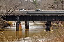
The mainline route follows the older, narrower William B. Umstead Bridge and goes through the community of Manteo before rejoining the bypass route to access a series of bridges and causeways that connect Roanoke Island to Bodie Island on the Outer Banks.
US 64 terminates at Whalebone Junction, a location in Nags Head that forms the three-way confluence of US 64, US 158 and NC 12.
Corridor A connects I-285, in Sandy Springs, Georgia, to I-40, near Clyde, it overlaps 35 miles (56 km) of US 64, between Hayesville and Franklin.
ADHS provides additional funds, as authorized by the U.S. Congress, which have enabled US 64 to benefit from the successive improvements along its routing through the corridor.
[6] Between 1939 and 1944, US 64/US 70 was removed from Knobs Landing (SR 1620), in Icard; in Statesville, US 64 is rerouted to its current routing, leaving NC 90.
[9] Same year, US 64 in Hendersonville was rerouted onto one-way streets (sixth and seventh avenues) through the downtown area.
[11][12] Same year, was placed on new routing east of Pittsboro, its old alignment was abandoned to make way for Jordan Lake.
[15][16] Also same year, US 64 was placed on new routing between the Clay-Macon county line to Franklin; its old alignment downgraded to a secondary road.
[18] Also same year, US 64 was placed on new bypass north of Rosman, with its old alignment to become US 64 Business; however, this was not approved by AASHTO, downgrading the former route to a secondary road.
[39][40] Also in the same year, NCDOT submitted a request, which was subsequently withdrawn to split-up US 64 through Brevard; instead US 64 Bus.
The old alignment instead was downgraded to secondary roads; NC 141 was extended .7-mile (1.1 km) south to meet the new route.
In Asheboro, a new US 64 Bypass was planned to go south around the city, with a new connector (an extension of NC 159 Spur) to the North Carolina Zoo.
[48] In June 2017, NCDOT confirmed the new bypass will be signed as mainline US 64, with the old alignment becoming a business route.