Underwater survey
Originally, soundings were made manually by measuring the length of a weighted line lowered to the bottom, bur after the development of accurate and reliable echo-sounding equipment it became the standard method.
Multibeam sonar with GPS position data corrected for vessel motion and combined in real time is the state of the art in the early 21st century.
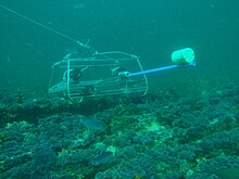
Bathymetric surveys of some bodies of water have required different procedures, particularly for sinkholes, caverns and caves where a significant portion of the bottom walls, and in some cases ceilings, are not visible to the sounding equipment from the surface, and it has been necessary to use remotely operated underwater vehicles or divers to gather the data.
One of the complications of this class of underwater survey is the relative difficulty of establishing a baseline, or an accurate position for the ROUV, as GPS signals do not propagate through water.
In some cases a physical line has been used, but sometimes a baseline can be established using sonar transducers set up at accurately surveyed positions, and relative offsets measured.
Surveys by professional divers tend to be relatively expensive, and some ecological monitoring programs and data gathering programs have enlisted the aid of volunteer recreational divers to conduct data collection appropriate to their certification and in some cases, further training, such as the Australian-based Reef Life Survey.
An underwater geological survey map typically superimposes the surveyed extent and boundaries of geological units on a bathymetric map, together with information at points (such as measurements of orientation of bedding planes) and lines (such as the intersection of faults with the seabed surface).
[7] They consist typically of a tight grid of high resolution (high frequency) reflection seismology profiles to look for possible gas hazards in the shallow section beneath the seabed and detailed bathymetric data to look for possible obstacles on the seafloor (e.g. shipwrecks, existing pipelines) using multibeam echosounders.
Such a survey may include investigation of hull structural and watertight integrity, extent of flooding, bathymetry and geology of the immediate vicinity, currents and tidal effects, hazards, and possible environmental impact of the salvage work.
[8] Structural integrity inspections of inland, coastal and offshore underwater structures, including bridges, dams, causeways, harbours, breakwaters, jetties, embankments, levees, petroleum and gas production platforms and infrastructure, pipelines, wellheads and moorings.
They are commonly used in a wide variety of underwater work, including oil and gas exploration, ocean sciences, salvage operations, marine archaeology, law enforcement and military activities.
When operating from a smaller vessel where transducer spacing is limited (i.e. when the baseline is short), the SBL system will exhibit reduced precision.
Ultra-short baseline acoustic positioning system (USBL), also known as super short base line (SSBL), consists of a transceiver, which is mounted under a ship, and a transponder or responder on the seafloor, on a towfish, or on an ROV.
USBLs are also used in "inverted" (iUSBL) configurations, with the transceiver mounted on an autonomous underwater vehicle, and the transponder on the installation that launches it.
In this case, the signal processing happens inside the vehicle to allow it to locate the transponder for applications such as automatic docking and target tracking.
Results of underwater surveys can be presented in several ways, depending on the target demographic and intended use of the data.
A common presentation format is a map indicating spatial distribution or general topography, often involving a depth dimension.