United States Geological Survey
The sole scientific agency of the U.S. Department of the Interior, USGS is a fact-finding research organization with no regulatory responsibility.
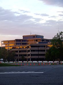
[2] It is headquartered in Reston, Virginia, with major offices near Lakewood, Colorado; at the Denver Federal Center; and in NASA Ames Research Park in California.
The USGS regional organization[9] aligns with the U.S. Department of the Interior Unified Interior Regions:[10] USGS operates and organizes within a number of specific science programs, facilities, and other organizational units: The Earthquake Hazards Program[11] monitors earthquake activity worldwide.
The USGS also runs or supports several regional monitoring networks in the United States under the umbrella of the Advanced National Seismic System (ANSS).
[12] The USGS informs authorities, emergency responders, the media, and the public, both domestic and worldwide, about significant earthquakes.
The goal of this department is to conduct research in geology, mapping, hydrology, biology, and related sciences; evaluate hazards associated with floods, droughts, hurricanes, subsidence, human activity, and climate change; map the onshore and offshore geologic framework; assess mineral resources and develop techniques for their discovery; assess water resources and develop an understanding of the impact of human activities and natural phenomena on hydrologic systems; assess links between biodiversity, habitat condition, ecosystem processes and health; and develop new technologies for collection and interpretation of earth science data.
In collaboration with Stanford University, the USGS also operates the USGS-Stanford Ion Microprobe Laboratory,[21] a world-class[citation needed][22] analytical facility for U-(Th)-Pb geochronology and trace element analyses of minerals and other earth materials.
The USGS also operates the National Wildlife Health Center, whose mission is "to serve the nation and its natural resources by providing sound science and technical support, and to disseminate information to promote science-based decisions affecting wildlife and ecosystem health.
The NWHC provides information, technical assistance, research, education, and leadership on national and international wildlife health issues.
The USGS is investigating collaboration with the social networking site Twitter to allow for more rapid construction of ShakeMaps.
[27][28] ShakeMaps are an interactive tool allowing users to visually observe the distribution and severity of Shaking resulting from Earthquakes.
Nearly 57,000 individual maps in this series cover the 48 contiguous states, Hawaii, U.S. territories, and areas of Alaska near Anchorage, Fairbanks, and Prudhoe Bay.
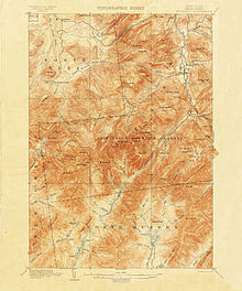
[30] The United States remains virtually the only developed country in the world without a standardized civilian topographic map series in the standard 1:25,000 or 1:50,000 metric scales, making coordination difficult in border regions (the U.S. military does issue 1:50,000 scale topo maps of the continental United States, though only for use by members of its defense forces).
[33] In 2008 the USGS abandoned traditional methods of surveying, revising, and updating topographic maps based on aerial photography and field checks.
[34] Today's U.S. Topo quadrangle (1:24,000) maps are mass-produced, using automated and semiautomated processes, with cartographic content supplied from the National GIS Database.
[34] As the digital databases were not designed for producing general-purpose maps, data integration can be a problem when retrieved from sources with different resolutions and collection dates.
The HIF was given national responsibility for the design, testing, evaluation, repair, calibration, warehousing, and distribution of hydrologic instrumentation.
HIF works directly with vendors to help them produce products that will meet the mission needs of the USGS.
For instrument needs not currently met by a vendor, the Engineering Group designs, tests, and issues contracts to have HIF-designed equipment made.
[38]: 501 In 1879, a report from the National Academy of Sciences prompted Congress to set up a federal survey agency, in part to inventory the vast lands added to the United States by the Louisiana Purchase in 1803 and the Mexican–American War in 1848.
The USGS was authorized on March 3 in a last-minute amendment to an unrelated bill that charged the new agency with the "classification of the public lands, and examination of the geological structure, mineral resources, and products of the national domain".